The Austral Highway: an adventure in the confines of Chilean Patagonia
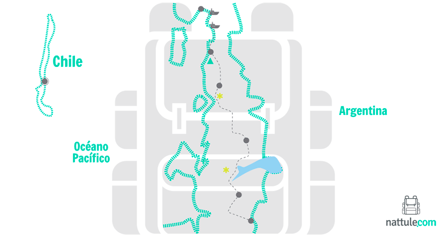
The Austral road, drawn with a knife in the south of Chile, runs through one of the most impressive landscapes on the planet: Patagonia. In its 1,240 kilometers of road, asphalt coexists with dirt tracks. The route is dotted with ancient forests, fjords, active volcanoes, lakes and turquoise rivers. In addition to extensive national parks and reserves.
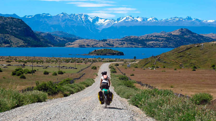
The journey begins in Puerto Montt (Los Lagos region) and ends in the town of Villa O'Higgins (Aysén region). You can explore it by car, bus or bicycle. Even hitchhiking, a very common practice in this area of South America. In addition, at several points you will have to resort to barges to continue.
It is advisable to be well informed of the schedules of the few bus lines that circulate here, if you go without your own car. Bringing a tent with you to rest while you wait for the next bus will make things a lot easier for you. As for the weather, it is unpredictable, which forces you to be predictable: bring a raincoat.
Regardless of inclement weather, every kilometer on this Chilean adventure is wonderful. In few places like this one you can carry out a similar variety of activities in the nature. Horseback riding, hiking, climbing volcanoes or descending spectacular rivers are just some examples of what this trip offers you.
Nattule describes the five sections into which this spectacular route is usually divided:
SECTION 1. From Puerto Montt to Chaitén, land of volcanoes
In this first section, 205 kilometers are traveled until reaching the town of Chaitén. Along the way you will have to take three barges.
Puerto Montt is the capital of the Los Lagos region, the starting point to start your tour of the Austral road, also called Route 7. First, you will advance south along a paved road, which borders the coast towards Pelluco.
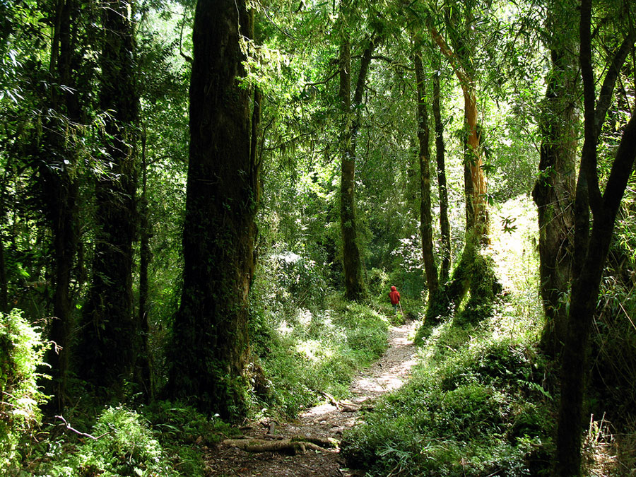
In the province of Llanquihue you will find the first attraction on your way. He Alerce Andino National Park It is located between the communes of Puerto Montt and Cochamó. It totals 20,000 hectares of larch forest, a native tree in danger of extinction that is highly appreciated in southern Chile. As for fauna, the presence of the puma, the pudú, the güiña and the mountain monkey stands out. You can explore the park's network of trails and visit the imposing Chaicas River waterfall.
 Alerce Andino National Park
At 46 kilometers you will find Caleta La Arena, the embarkation port for the crossing through the Reloncaví estuary. You will have to take one barge that arrives at Caleta Puelche in about 30 minutes. This ferry does not require reservations and is boarded on a first-come, first-served basis. You have to pay on board. Once in Caleta Puelche, it is 10 kilometers of gravel road to reach the small town of Contao on the banks of the Reloncaví Sound.
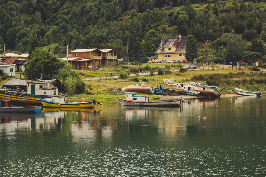
The journey continues through small fishing coves, such as Manzano or Gonzalo. In the Pichicolo fjord you can take the opportunity to relax in the hot springs located a few kilometers away. Later you will arrive at Hornopirén, the communal capital that has several accommodation options and restaurants where you can taste the cuisine of the area. There you will have to make the second transfer.
After crossing the Black and White lakes you will reach Santa Bárbara beach. If you are a lover of water sports or if you simply want to cool off, you should stop at this beautiful beach, from where you can see the Corcovado volcano.
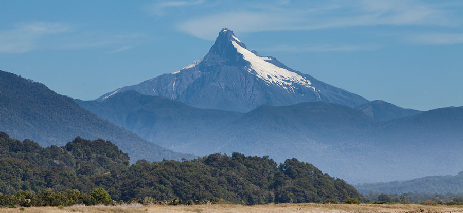 Corcovado Volcano (Austral Highway)
Only some experienced mountaineers have reached the top of this volcano, given its difficulty. The presence of southern forests and its complicated orography make it especially complicated in the final stretch. However, mountain lovers will enjoy being at its feet and contemplating its majestic summit.
At the end of the route is Chaitén. Don't expect to find a big city. This former provincial capital is currently almost abandoned, since in 2008 the volcano that gives it its name devastated the population. However, you will be able to obtain basic supplies and accommodation services, since the town is under reconstruction.
If you have enough time, do not hesitate to visit the island of Chiloé. A barge moves to it from the port of Chaitén two days a week.
 Chiloé National Park
SECTION 2. From Chaitén to La Junta, the world's rafting paradise
This second section consists of about 150 kilometers, most of them on tracks away from asphalt. From Chaitén, about 25 kilometers south, the road will take you to the Amarillo hot springs, where you will find camping areas, as well as inns and cabins.
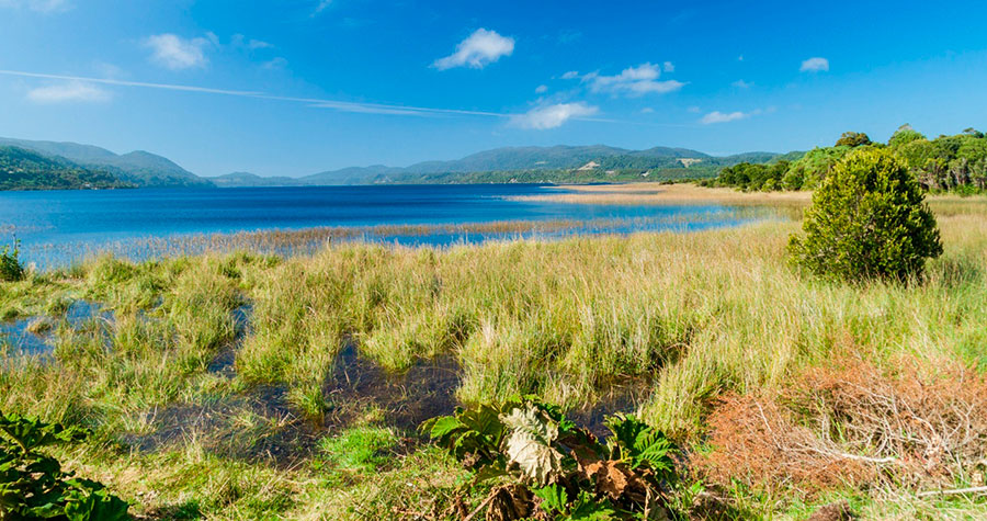
If you continue heading south, you will reach the shores of Lake Yelcho. This beautiful lake attracts fishermen who come from various places around the world in search of trout and other species of salmon. On the banks you will find a multitude of picturesque wooden inns where you can spend the night or stay for a few days.
 Yelcho Lake
Leaving Lake Yelcho behind you will arrive at La Junta, the northern gate of the Aysén region. In this town you will have accommodation, restaurants and inns. And something as essential if you go by car as fuel. It also has internet access, telephone and tourist information.
La Junta is also known as El Pueblo del Encuentro, since the most important rivers in the area, the Rosselot and the Palena, meet here, and several paths converge. To the east you reach Lago Verde, to the west to Raúl Marín Balmaceda and to the south to Puyuhuapi.
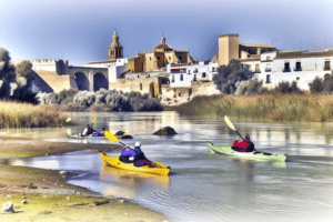
At this crossroads the rivers stand out for their spectacular beauty and crystal clear waters. They are also world famous for kayaking and rafting. This is the case of the Futaleufú River, a place of pilgrimage for lovers of water sports.
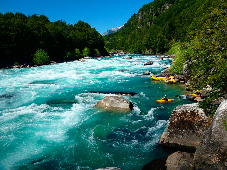 Futaleufu River
Whitewater kayaking is an exciting adventure tourism experience. You can practice it with this kayak activity on the Ulla river, in Galicia.
SECTION 3. From La Junta to Coyhaique, in the heart of Queulat
From La Junta, the road will take you towards Puyuhuapi. On your way you will find Lake Risopatrón, the largest in the Queulat National Park. This Andean paradise of more than 150,000 hectares is one of the least altered areas of Chile. In the mountains of Queulat there are majestic forests of Magellan oak or coihue and white oak that make this enclave a unique place.
After traveling about 45 kilometers you will arrive at the town of Puerto Puyuhuapi, located at kilometer 192 of the journey. You will be surprised by its Central European architecture houses imported by the first German settlers and the beautiful rugs that are made by hand. It is possible to get one at local markets.
Puyuhuapi is an ideal enclave to set up your camp, replenish your strength and fuel for the car, and stay a couple of days doing some sightseeing.
 Puerto Puyuhuapi
After leaving Puyuhuapi you must head towards the beautiful valley of the Ventisquero River, a very little-known place that hides another of the treasures of the Queulat National Park: an ancient glacier that is located between two large rocky masses. It pours its waters into the melting ice over a cliff and, with the arrival of cold weather, the waterfall crystallizes, forming a large tongue of ice. Hence it is called Hanging Snowdrift.
There is a well-marked network of trails that will take you to the glacier moraines. You should also not pass by the Enchanted Forest trail, one of the most beautiful in Queulat.
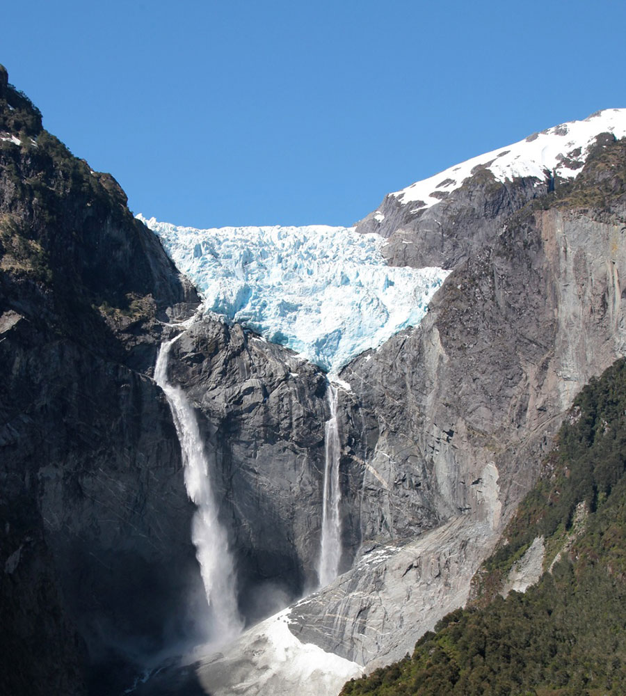 Hanging Snowdrift
Further south, the city of Puerto Cisnes, an important coastal city, and the majestic bed of the Cisnes River await you. Two other attractions to highlight in this area.
From Puerto Cisnes, you will reach the Lago Las Torres and Mañihuales National Reserve. Shortly after, you are presented with 2 alternatives: continue the original route that goes directly from Villa Ortega to the capital Coyhaique or, alternatively, take the detour to Puerto Aysén that borders the Simpson River Reserve to the capital itself.
 Simpson River National Reserve © José M. Moya
The native term Coyhaique means “camp between rivers” in the Tehuelche language. As tiredness is surely taking its toll, it is advisable to make a little bit of life in this beautiful and quiet city. If you have the opportunity, visit the San Rafael lagoon and the Ñirehuao mountains.
SECTION 4. From Coyhaique to Cochrane, the province of glaciers
The capital of the Aysén region, Coyhaique, divides the Austral road in two halves: northern zone and southern zone. The northern area has a greater amount of vegetation due to frequent rains and a greater number of human settlements. The southern area is different, but spectacular.
As you travel kilometers towards the southern reaches of the world, you will notice that the terrain becomes more inhospitable. The forests give way to the southern steppe, the wind becomes increasingly stronger and the human presence is progressively reduced. The feeling of calm there is remarkable, derived from entering a remote place, away from the hustle and bustle of big cities.
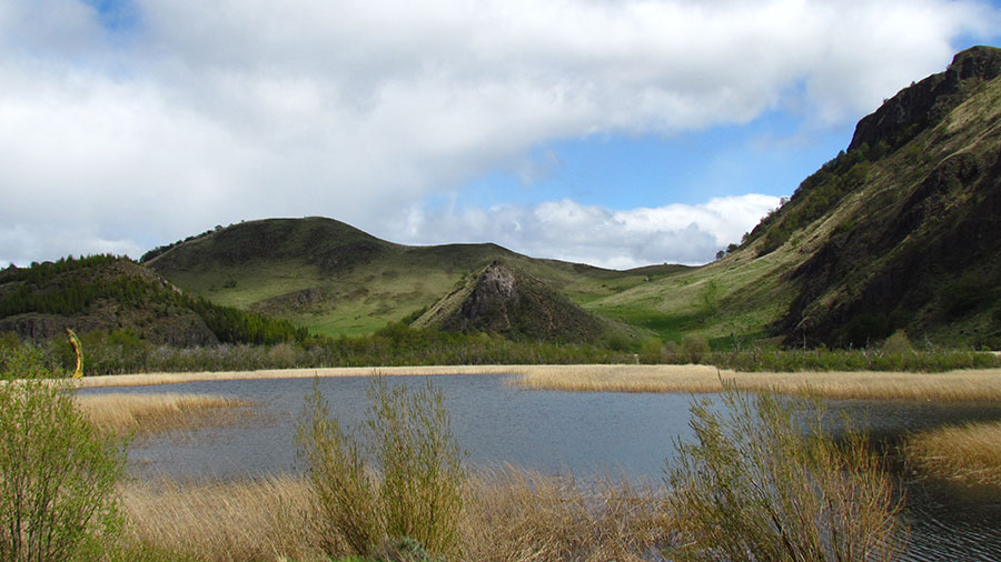
This 334-kilometer stretch has countless protected wild areas of great environmental and tourist interest; as well as rivers, lakes and lagoons suitable for recreational fishing. As soon as you leave, just 7 kilometers from Coyhaique, you will find the Foitzick lagoon, surrounded by reed beds and swampy lands. It owes its fame to the so-called Chinese Wall, a wall-shaped rock created by a flow of solidified lava.
 Foitzick Lagoon (Austral Highway)
Once you have traveled 60 kilometers of paved road, you will reach the Cerro Castillo National Reserve, a place of dazzling beauty. In its almost 180,000 hectares, the presence of plants such as ñire, lenga, ciruelillo, calafate and chaura stands out. Also animals like the huemules, a species of deer characteristic of the Aysén region that is in danger of extinction.
However, its main attraction is the massif of peaks covered in snow all year round, which invite you to take walks and excursions. You can hire specialized guides in the Cerro Castillo village, located in front of the massif. This small and picturesque town of just 400 inhabitants has accommodation and all the necessary basic services.
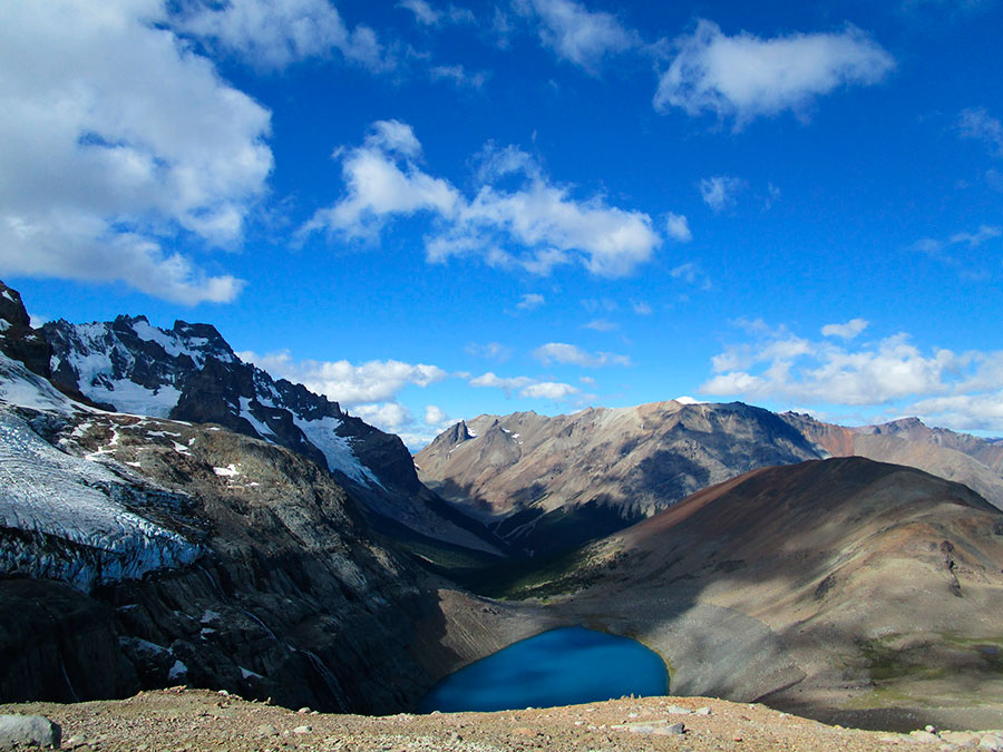 Glacier Lagoon at the foot of Cerro Castillo © José M. Moya
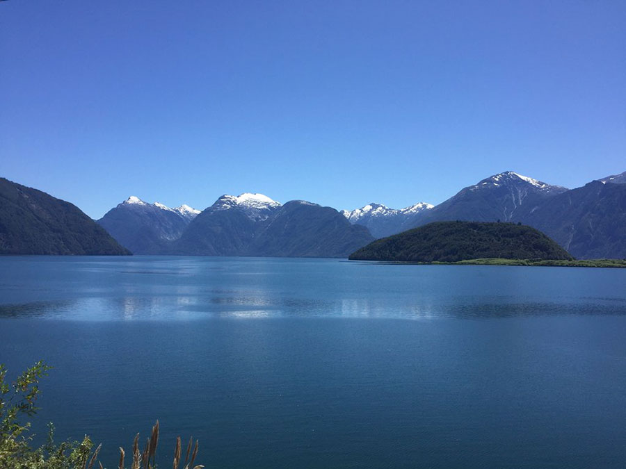
The road continues along the banks of the Murta River until reaching a crossroads that leads to the picturesque town of Bahía Murta, located on the northern shore of Lake General Carrera. This is the largest lake in Chile and the second in all of South America, after Titicaca. Murta has inns and lodgings, food stores, a first aid station, telephone and supermarket.
 General Carrera Lake (Austral Highway)
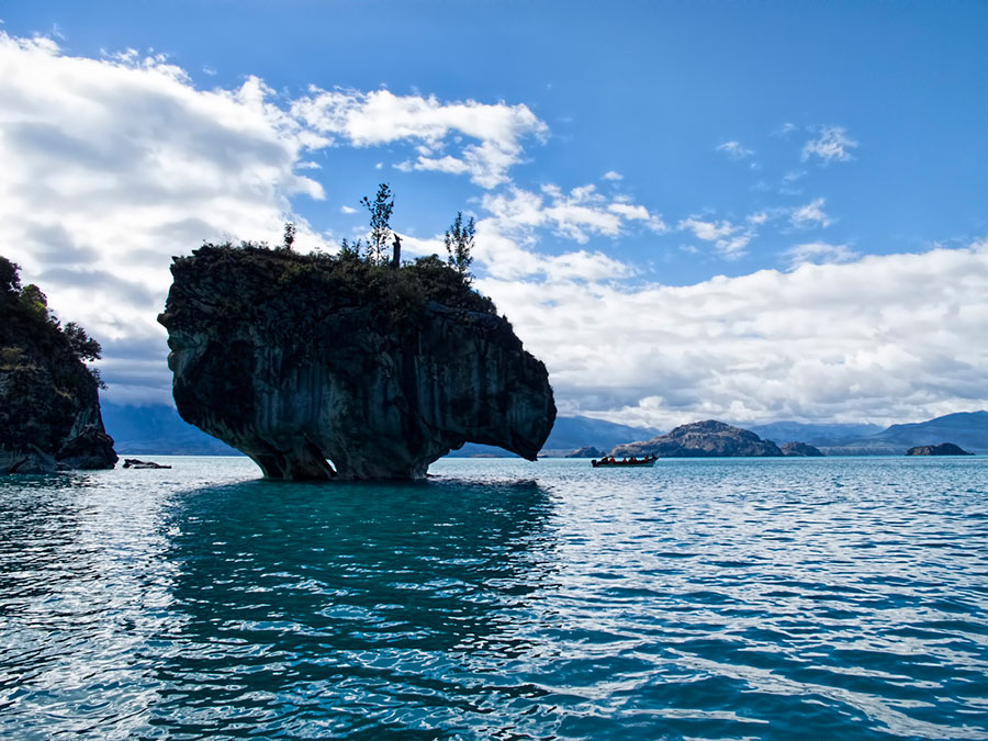
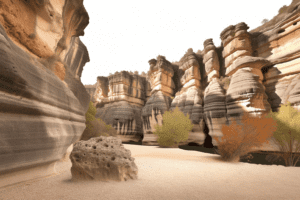
From the crossing to Bahía Murta, in about 30 minutes, you will arrive at Puerto Río Tranquilo. The main charm of this town is that boats leave from here to the Marble Cathedrals, incredible rock formations that emerge from the depths of this enormous and beautiful lake. Numerous boats leave the port every hour, so there is no problem boarding. Sunset is the best time of day to visit them.
If you are intrepid you can also take an excursion to the Los Exploradores glacier, although it is mandatory to be accompanied by a guide. You will find several possibilities to hire them in the same city. Cramming through the moraine of this glacier, entering ice caves and marveling at the view of the highest mountain in Chilean Patagonia (Monte San Valentín) is an unforgettable experience.
Chile is not the only country in America with impressive glaciers; There are also them in North America. You can visit some of them in this 15-Day Canada Wilderness Trip.
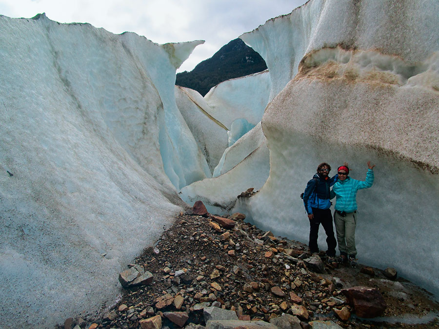 Los Exploradores Glacier © José M. Moya
Further ahead you will find a small detour that leads to the town of Puerto Bertrand, a picturesque town surrounded by mountains and lenga forests, nestled on the shores of the lake of the same name. The powerful Baker River, the largest in Chile, is born in this area. Its turquoise waters are excellent for rafting. You must visit the point where this river joins the course of the Nef River. The contrast created by the mixture of both waters is indescribable.
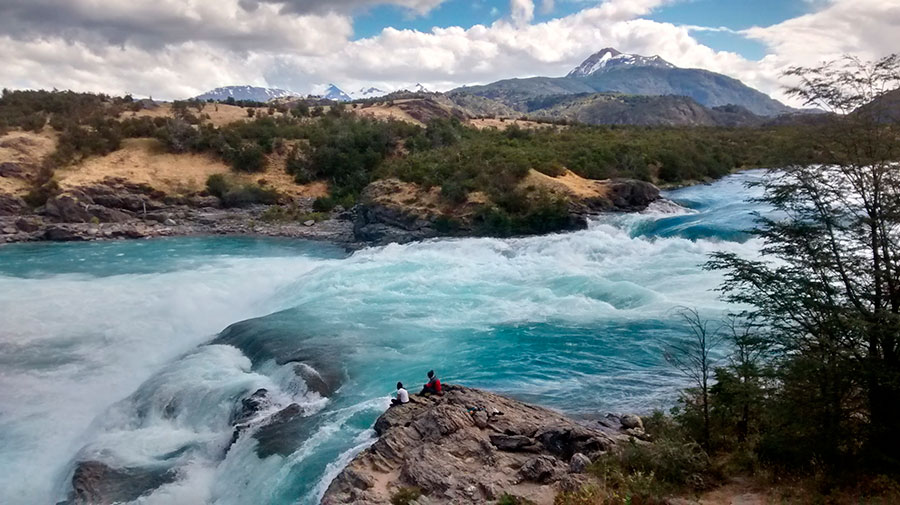 Confluence of the Baker and Nef rivers © José M. Moya
Finally you will arrive at Cochrane, capital of the Capitán Prat province, also known as The Province of Los Glaciares. Cochrane is one of the main and most complete supply and service centers south of Coyhaique. In the surroundings of this town there are several attractions to visit, such as the Paso San Carlos National Monument and the Tamango National Reserve. There you can take excursions aimed at sighting huemules and other species of Chilean fauna.
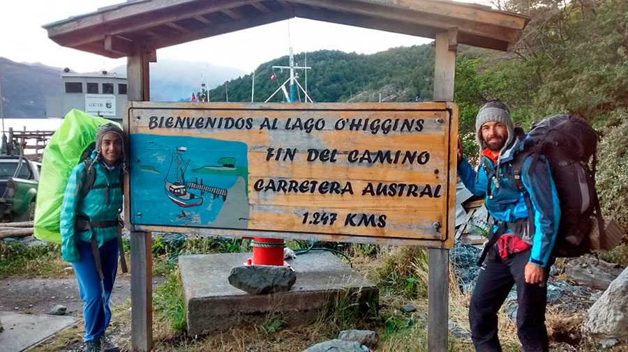
SECTION 5. From Cochrane to Villa O'Higgins, on the edge of the border
Cochrane is the last settlement of any size in the south of the Austral road. If you need to withdraw money or buy supplies, this is the right place. You are about to enter the final stretch of your journey, the most inhospitable of all. Its final point is near Villa O'Higgins, a town with colorful houses reminiscent of a village from the movie. The Truman Show.
From Cochrane to Caleta Tortel there are 128 kilometers of unparalleled beauty. You will tour the protected wild areas near the town, where you will be able to appreciate the Esmeralda, Chacabuco and Vargas lakes, and then border the Baker River until you reach its delta. Caleta Tortel is located right there, considered one of the most beautiful towns on the planet.
 Caleta Tortel (Carretera Austral)
This Patagonian town can only be explored on foot. Its streets have been replaced by beautiful walkways built with Guaitecas cypress wood (a species endemic to Patagonia), which led to its declaration as a Typical Zone. You will be shocked by the peculiar smell that the cypress wood gives off and that permeates the entire area. Another of the attractions of Tortel are the numerous hummingbirds that flutter in search of food in the wooded areas of the town.
After Caleta Tortel, you must continue in the direction of Michel Fjord, where Puerto Yungay is located. There they board a free barge that, in order of arrival, takes travelers on a journey of about an hour to Río Bravo. After disembarking, you must continue the trip along a road flanked by an abundant native forest of araucarias, lingues and oaks.
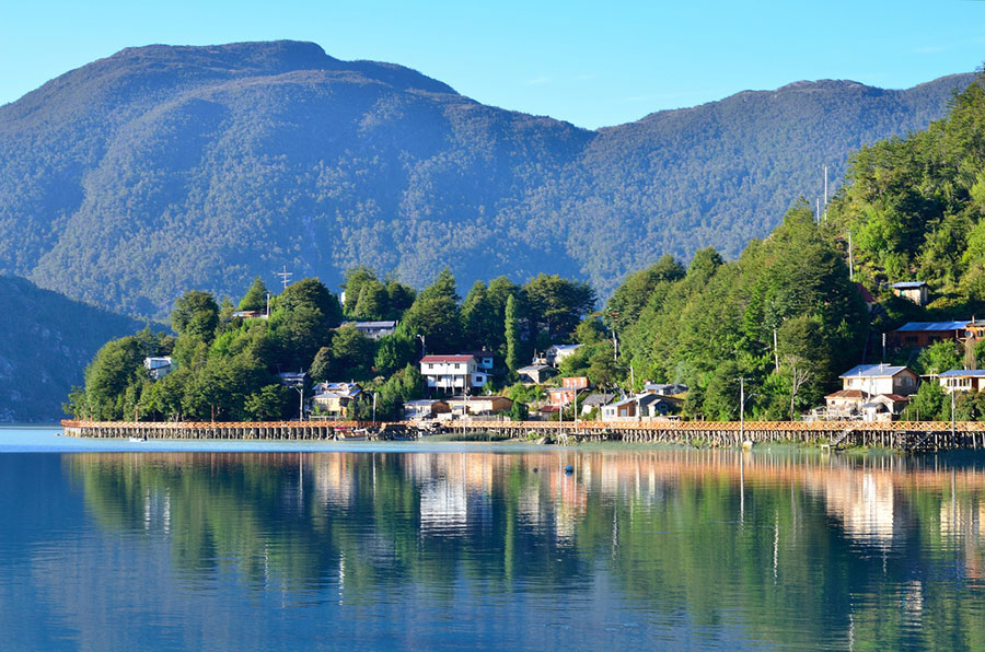
You only have 100 kilometers left to Villa O'Higgins. This small and attractive border town, located on the shores of the lake of the same name, marks the end point of the Austral road.
 End of the Austral Highway © José M. Moya
Lake O'Higgins, located between Chile and Argentina, is one of the largest lakes in Patagonia. With more than eight branches, it is fed by melting ice from the glaciers of the Southern Ice Field and the Mayer River, which flows near Villa O'Higgins.
From Puerto Bahamondes, 7 kilometers from the town, excursions leave to the O'Higgins Glacier or the Candelario Mancilla Pass, better known as the Dos Lagos Crossing, which connects by land with the Argentine town of El Chaltén.
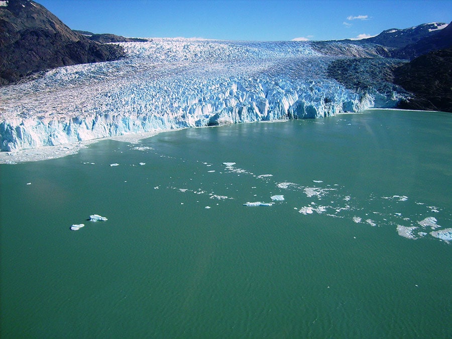 O'Higgins Glacier
[hr type=»line»]
Patagonia is not photographed, it is lived. Paris is something else. The Eiffel Tower is an accomplished model, Nikon meat. In the Austral road No image would capture in its proper measure the calm of the lakes, the bravery of the fauna, the transparency of the sky. There are those who prefer the memory of the kiss to the kiss itself, but, if you are not one of them, Chile awaits you.
[hr type=»line»]


Magnificent and detailed article. Congratulations!
Greetings!
Thank you so much! I'm glad you liked Gustavo. All the best
We are going to go and we loved the detail of the article. It is sure to be very useful to us.
We will tell you what we visited.
Thank you
I'm glad you loved it. I'm sure you won't be disappointed! Of course, tell me how about your adventure. All the best
Traveling the Carretera Austral is a breathtaking adventure, filled with stunning landscapes. After the trip, taking good care of your car with quality products ensures its optimal performance and durability.
The article effectively communicates a critical and beneficial point. Your willingness to provide your readers with this well-written and beneficial information is greatly appreciated.