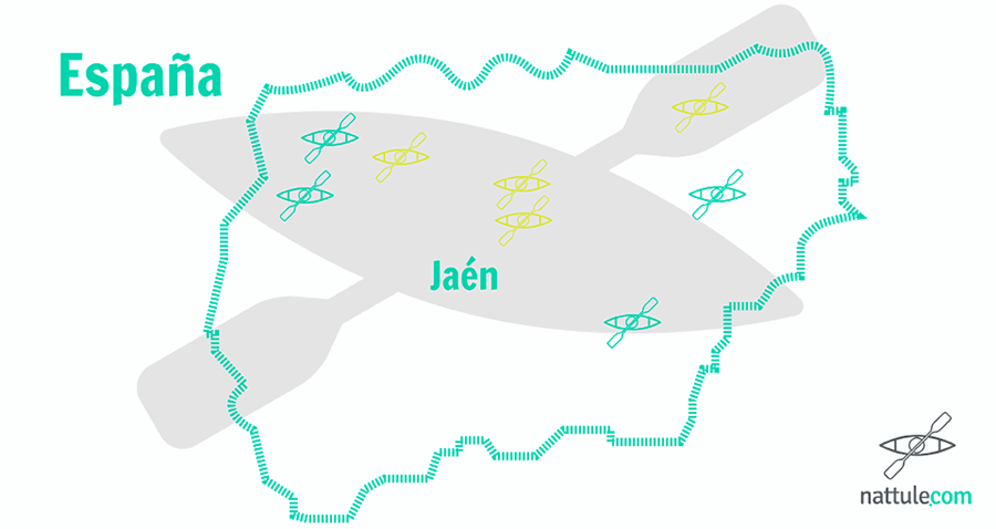
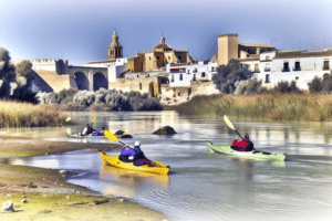
Kayaking in Jaén: from Cazorla to Sierra Morena along 8 navigable roads
The south of Spain is home to a variety of landscapes that make it one of the best destinations for nature lovers. activities in the nature.
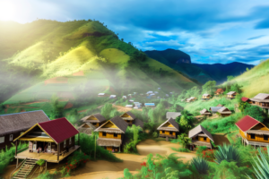
One of the most representative examples of this diversity is the province of Jaén. Its important water courses, its particular relief and engineering have combined to turn this province into the cistern of Andalusia.
Most of the reservoirs and dams in the province are part of or border many of Jaén's natural spaces. These bodies of water also have the added tranquility that gives them the character of a province far from traffic, from which even the rush flees slowly.
If in the past the need to master the liquid element sharpened the ingenuity of civilizations to be able to function in it, now is the time to focus your energies on shoveling, discovering inaccessible corners and feeling nature in a different way.
Kayaking in Jaén: Eight recommended reservoirs
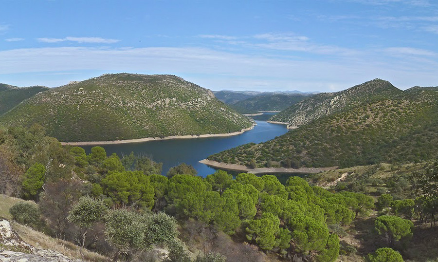
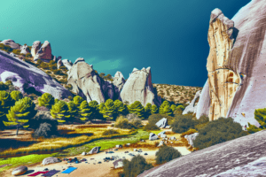
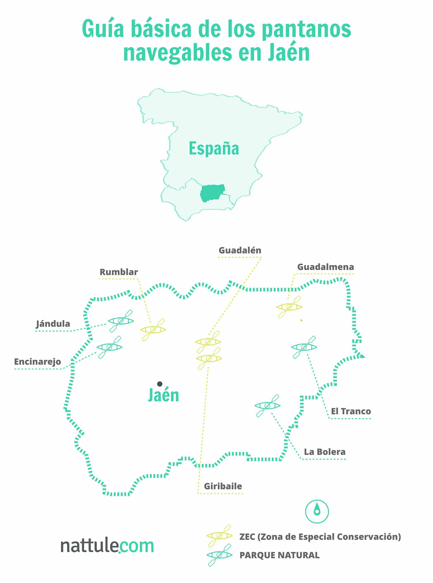 1. El Tranco
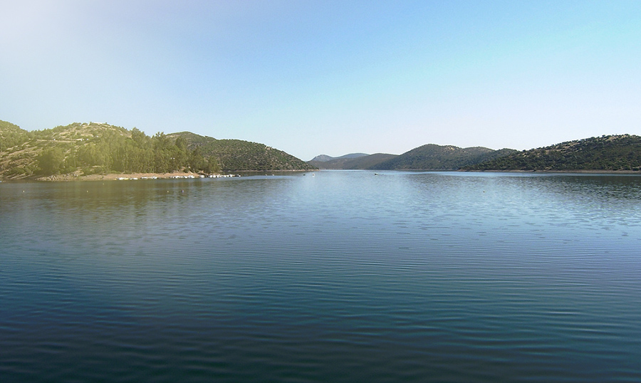
El Tranco is a reservoir with a lake vocation, the treasure of water that the traveler who visits Jaén discovers. A treasure that offers one adventure or many: kayaking, boat trips, extreme swimming, hiking. There are multiple activities that you can do in its 1,800 hectares of area.
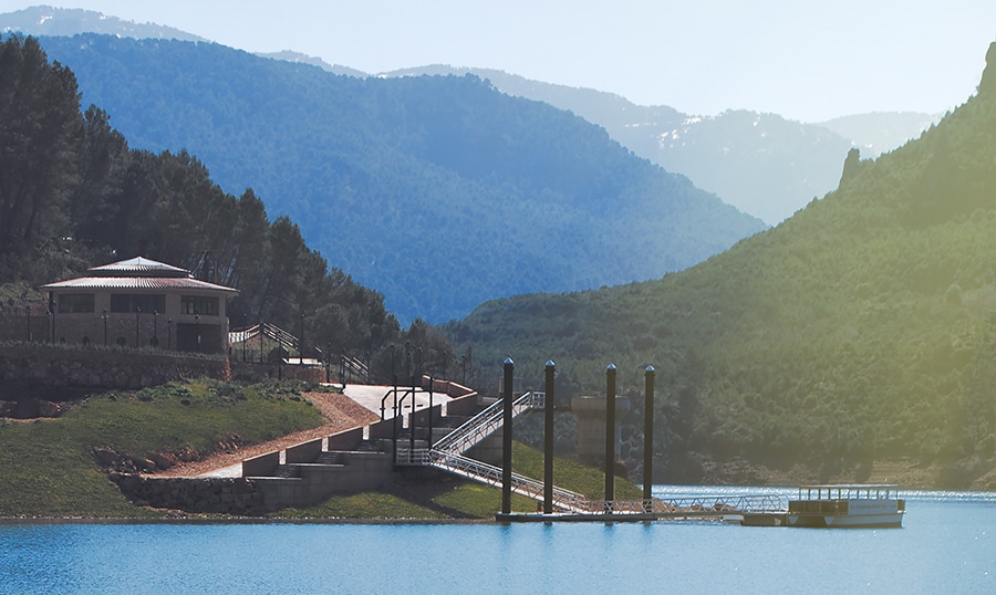
From the kayak, the places surrounding the reservoir will bring you serenity or shock, adrenaline or calm. You can make a quiet outing, with peaceful paddles to enjoy a sunset, or you can propose to explore it, do not give up the effort and discover its most unknown corners. Its twists and turns and the sensations you will experience will compensate for your daring.
Can rent a kayak in the Tranco reservoir and take one of the two tours that I recommend:
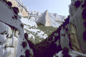
Chorreón Route
If you visit Tranco, this route is not an alternative, it is an obligation.
If you decide to start at the main pier, located near the dam wall, you must detour along the left arm towards the north. You will first pass through a narrowing from which you will see in the distance the town of Hornos de Segura, an example of environmental management in the area.
Continuing in that direction, the reservoir widens and on your left bank you will find the Montillana stream, the Parrizones and a few meters later, in a bend, the Chorreón waterfall. This is formed when the Cañada Morales stream pours its waters into the reservoir. In this enclave you can visit the hot springs of a Roman villa or see the old town of Soto de Abajo, from which the church bell tower sometimes emerges from the waters.
Route of Félix Rodríguez de la Fuente
Starting from the pier heading south, you will see on your right bank the areas where the Control Viejo viewpoint and, further on, the Solana de Padilla viewpoint are located.
It is in this area of the reservoir where you will begin to skirt the large island of Cabeza de la Viña, which is on the left, and you will reach the area of Bujaraiza, a well-known scene of deer fights during the rut next to the remains of the medieval castle. The place offers charm and nature in its purest form.
Here is a small preview of everything you will find in this kayak route in Cazorla, Segura and the Villas. I hope the bug bites you.
To finish, we recommend that you have lunch at the Tranco restaurant with excellent views of the reservoir and a gastronomy mix of tradition and avant-garde.
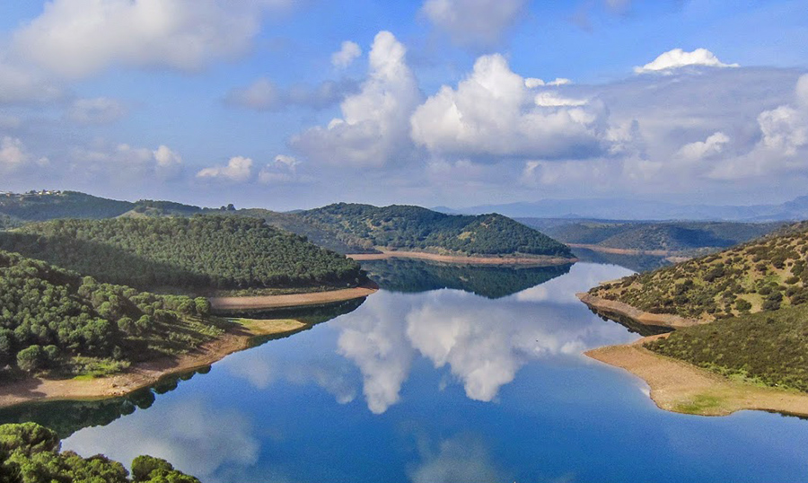
2. The Bowling Alley
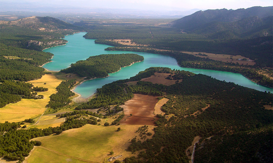
La Bolera is a brief but intense swamp, like a handshake. Life vibrates in its barely 6 kilometers of length. Otters and grebes compete for food in this area located in the Cazorla, Segura and Las Villas Natural Park.
The quiet beauty of La Bolera invites you to sail its waters by canoe, from which two contrasting landscapes can be distinguished: the forested and the desert. Glades surrounded by pine forests, aridity and groves. If after the walk you feel like cooling off, there is an area set up for swimming near the dam.
The landscape contrast is just one of the attractions offered by this reservoir located 7 kilometers from Pozo Alcón, also close to Quesada (birthplace of Rafael Zabaleta), from whose viewpoint you can see its waters.
In the place where the Rambla stream pours its waters into the swamp is the entrance to a cave known by the same name. This remains flooded when the swamp is full, but in dry years it can be a good option to complete your visit.
With this caving activity in the Sierra de Segura You can explore both this cave and the Lower Cave.
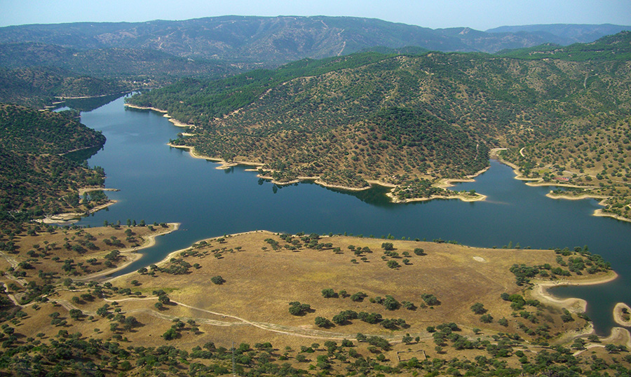
3. Jandula
The Jándula reservoir is a bluish balcony with views of the Sierra Morena. Its more than 20 kilometers of extension, reaching almost the limit with the province of Ciudad Real, offer you spectacular places covered in very well-preserved Mediterranean forest and areas of pine forest dotted with pastures.
To get there, take the road that goes up to the sanctuary of the Virgen de la Cabeza from Andújar until you reach the tourist complex “Los Pinos”. At this point take the detour to the right and drive for 15 kilometers. The signage is clear, you will not have problems.
Its waters offer you the possibility of sailing through one of the most unique corners of the Natural Park. In addition, it is an area classified as a Starlight Tourist Destination, due to the quality of its night skies that make it an ideal place for stargazing and astronomy. If you dare to sail at night, this is the perfect opportunity.
The flora and fauna are other aspects to highlight on this tour. Species such as the Iberian wolf, the black vulture, the imperial eagle and the Iberian lynx are present in this environment. Try booking the experience observation of the Iberian lynx in the Jándula. Furthermore, in the southern part there is the only population of mountain goats inside the Natural Park. Griffon vultures in its northern part, around Puerto Alto and Puerto Bajo, and the nesting of the black stork are other attractions that you will enjoy.
The impressive environmental props and the spectacular natural scenery turn navigation along the Jándula into a unique experience. The itinerary does not avoid surprises, such as the possibility of docking in the town of La Lancha, an uninhabited enclave where the church remains standing.
4. holm oak
Also in the Sierra de Andújar, the Encinarejo is the youngest of the navigable swamps of Jaén, an apprentice reservoir that has a 5-kilometer course, enough length for a pleasant canoe ride.
The best access is a dirt track that goes off to the right along the road that leads to the sanctuary of the Virgen de la Cabeza, just after passing a bridge that crosses the Jándula River. On the right bank of the swamp there is a recreational area where you can leave your car and from where you can board.
Downstream from its older brother, the Encinarejo is also an ideal habitat for the Iberian lynx, the black vulture and the imperial eagle.
In the northernmost area of the route you will reach the Sardinillas River, one of the best preserved waterways in this area of Sierra Morena Oriental, which stands out for its riverside forests and where you can navigate at its mouth. This area of the Jándula River is one of the last refuges of the bogardilla, a fish endemic to the Guadalquivir basin.
Another activity you can do is a hiking route from the nearby town of Encinarejo that will take you to the reservoir and, following the Jándula River, to the entrance of the Natural Park.
Do you want to know the most emblematic of the Sierra Morena species? Sign up for this activity to observe the Iberian lynx after your kayak ride.
5. Rumblar
A sea port in Sierra Morena. The reservoir is close to the municipality of Baños de la Encina, which has one of the best preserved castles in Andalusia, National Monument and tourist complement of the area.
The best option is to start browsing the Tamujoso beach and discover places practically inaccessible with other means of transport, so make your kayak route in the Rumblar and discover:
- The mouths of the Murguigüelo and Retamón streams or the Pinto River (4 kilometers from the main channel in the longest arm of the swamp).
- Remains of the Argaric site of Peñalosa, dating back to the Bronze Age (from the northern part of the reservoir you can arrive with your kayak).
Keep in mind that its banks are full of slate flakes that are somewhat uncomfortable. In addition, in the surrounding area you have good options for hiking, such as Peñalosa route. Conclusion: put on some good boots.
6. Guadalen and Giribaile
Still in Sierra Morena, in the Condado region, these bodies of water are an alternative for navigation when the weather does not allow it in mountain or mid-mountain reservoirs.
They are chest swamps: authentic archaeological treasures are submerged in the bed of these two. The only bridge built by one of the geniuses of the Renaissance, Andrés de Vandelvira, emerges over the waters of the Giribaile during a period of drought. Giribaile is surrounded by pastures and bulls, castles and an ancient Iberian city, Orisia.
Its waters also have a lot to say. The Guadalén reservoir invites you to practice navigation and walk along its banks.
There are those who say that Atlantis is hidden under these waters, and not under the sea as has always been thought. Maybe you could investigate on the spot.
7. Guadalmena
3 arms of 8 kilometers each add up to twenty-four. That is the distance that can be navigated in this large swamp, nestled between Sierra Morena and Sierra de Segura.
The best access to reach the flow starts from the yacht club. And the best option is to choose the arm that crosses the Guadalmena River valley.
This reservoir is one of the few in the province of Jaén where it is possible to sight the osprey during the winter months. It is also well known for its pike fishing, the “freshwater shark” that was introduced for sport fishing.
That said, choose your swamp, and keep in mind that to navigate any of them you will have to request a authorization to the Guadalquivir Hydrographic Confederation.
It is also recommended that you follow some tips to make your adventure safe:
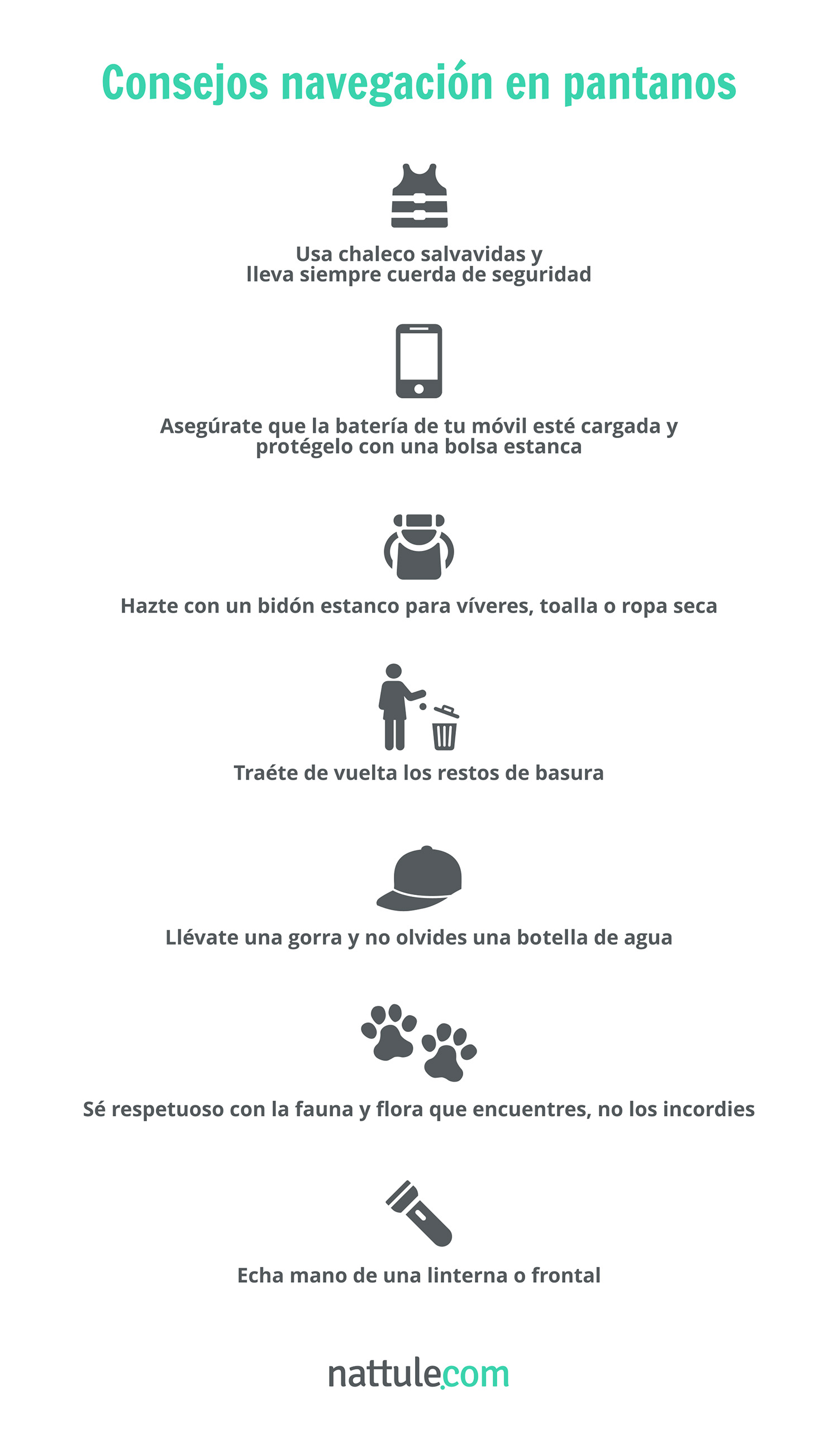
A swamp is a sea that has run a marathon. If it remains still it is because of fatigue: before being a reservoir, it was runoff. Those who visit it are generally looking for peace and quiet after a busy year. Calm attracts calm. For certain people, this tourist destination is their better half.
Don't wait any longer, put your kayak on the roof of the car, and let yourself be carried away in this interior Paradise.
Write down what you see and don't hesitate to write to me!


Does anyone know how long it takes on average for navigation authorization to arrive? And the extra permit needed for the tranco swamp?
You must present the responsible navigation declaration 15 days before the activity and it will only be valid for that day and that specific place, but if you want it to be valid for 12 months (and in this way you do not have to be subject to dates so that you can plan your trips whenever the weather allows it), it will be enough for you to mark the corresponding box with an “X” and pay the established fee, so that a registration is assigned to your boat.
If everything is OK, they will not notify you, authorization is understood to have been granted by positive silence. Which may be your case.
Although if you don't have a registration yet, they should send you the registration, but it takes a little longer.
It all boils down to the fact that within 15 days you can navigate from the moment you submitted your responsible declaration.
Fati, I'll tell you as far as I know:
After the presentation of the Responsible Declaration, the Confederation can act in two ways:
In the event of INCOMPATIBILITY of the content of the responsible declaration with the protection and purposes of the public hydraulic domain, the Confederation will notify you, through a reasoned resolution, of the impossibility of carrying out this activity.
In case of COMPLIANCE with all the requirements for navigation and floating, the Confederation will notify you, by means of a letter of transmission, of the registration of the vessels, the validity period of the declaration and other information of interest for the beginning of the exercise of the activity. .
I hope you find it useful,
All the best!
That is, if the vessel already had a registration, and did not receive notification within 15 business days of entry into the Confederation registry, it will be understood that you will be able to begin carrying out your activity.
Therefore, it depends on whether or not you have registration. Although I also tell you that there are cases in which it does not notify, so if those 15 days have already passed, with your responsible declaration you will have no problems navigating.
If you have questions, call 953250540 and ask for Estela.
Thank you so much for the answers. I don't have registration yet and I applied two months ago. According to the confederation, after 15 days I can sail.
But according to Seprona, to navigate the Tranco you need another separate permit granted by the Park, I have also requested it but I saw two months ago that I requested the other one because the same thing for 2020 I get a response. As I said, thank you for the answers, I will tell you if I am lucky and they send me even the registration and payment of the fee.
Very good article! I enjoy reading your exceptional information on the things you can do in natural parks.
Thank you
Can you help me ? Do you know if to fish from kayak or paddle in the Jandula reservoir, I need a permit from the natural park apart from the one already issued by the Guadalquivir Hydrographic Confederation??? Thank you so much
artemar.es
Being passionate about sailing and collecting miniatures combines adventure with detail. Sailing inspires freedom and exploration, while collecting miniatures reflects patience and admiration for the precision and history in each piece.
escuelanavega.com
Si te mola el kayak tanto como a mí, Escuela Navega es perfecta para aprender a navegar. Buen rollo, clases top y mucho mar. ¡Nada como remar y desconectar a lo grande!