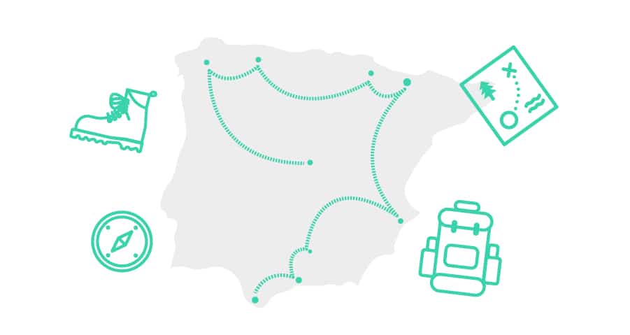
9 Hiking Routes in Spain to enjoy in Summer and Autumn
The summer is coming to an end, the autumn begins, the holidays are over and, nevertheless, it is hard for us to find the desire to stay at home.
After these months of travels and adventures in nature (for the lucky ones who have been able to do so), going back to routine is hard. Therefore, it is best to do it little by little. Even if it’s your turn to go back to work, you can take advantage of the weekends to continue hiking.
And it is that, although we are already in September, the heat has not made a move to leave. Moreover, it is as present as it was a month ago. That forces us to prescribe a basic advice: Walk? Yes, but knowing how and where.
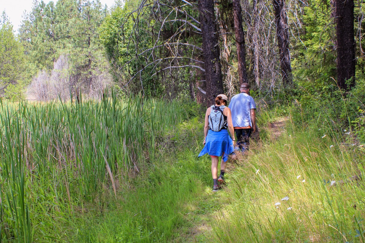
We can not forget that on summer routes, the shade is essential. If there is a shadow on the road, we can finish a route comfortably; without getting tired before time and, above all, without returning completely burnt or, worse, suffering from a heat stroke.
Therefore, I propose 9 perfectly detailed hiking routes so you can choose your favorite in these sunny days.
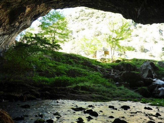
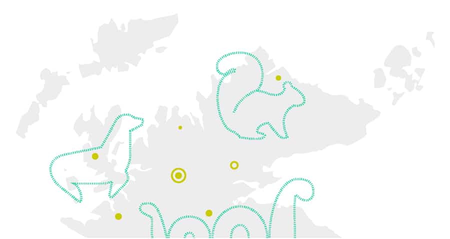
1) FROM THE UTRERA STRIKE TO THE CAVE OF THE WATER (JAÉN)
Being the largest protected area in the Iberian Peninsula, the Natural Park of Cazorla, Segura and Las Villas boasts a large number of trails and paths to travel. Moving away from the busiest areas we find the route of the Cueva del Agua, in the Sierra de Segura.
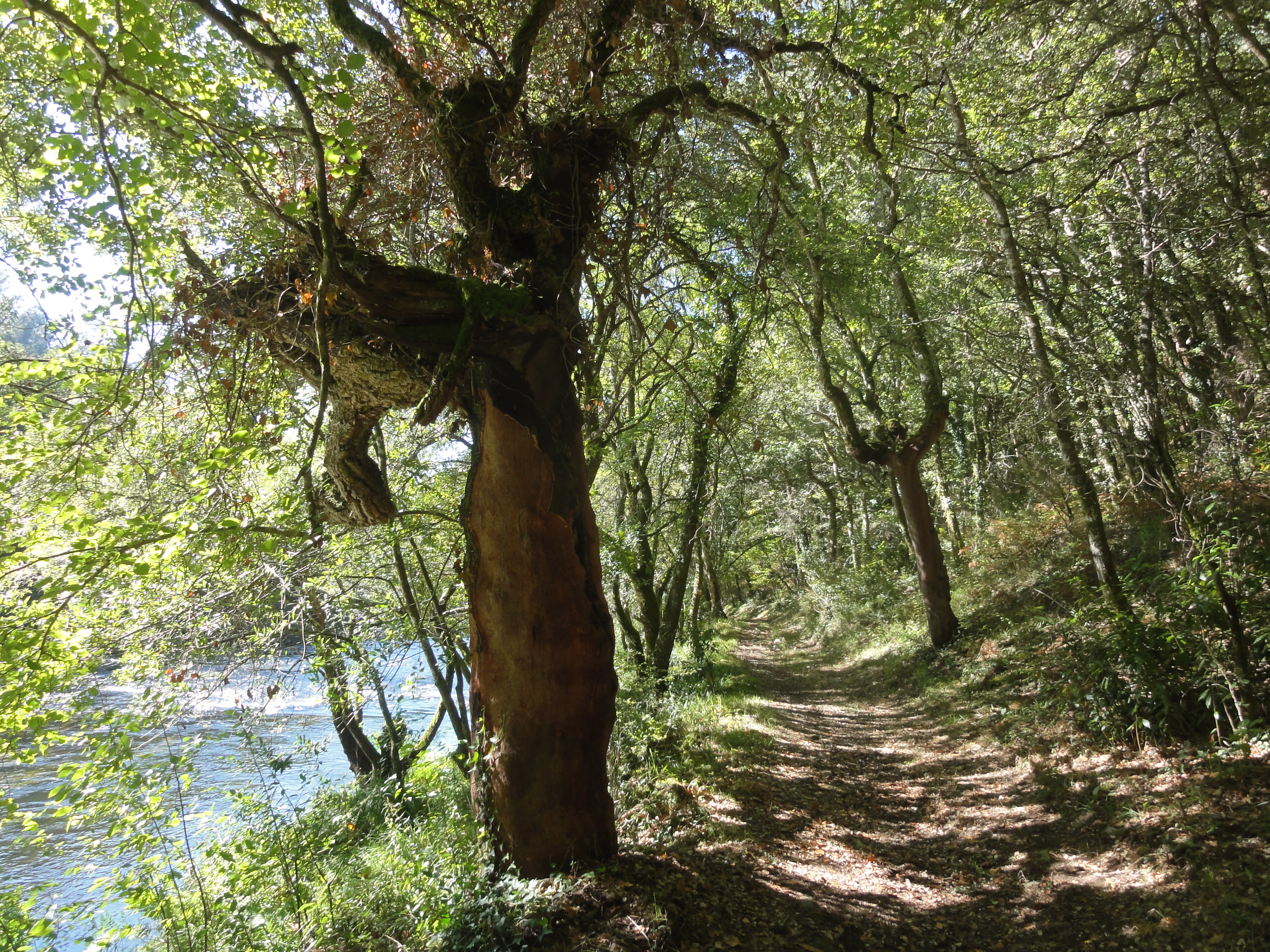
The route begins in the small village of Huelga Utrera, accessible from the JF-7038 road. From the same village, the road starts in a westerly direction that climbs up the Segura River on its left bank. The trail is well conditioned and signposted with markers. After that first climb, it begins to flatten, through orchards and fruit trees.
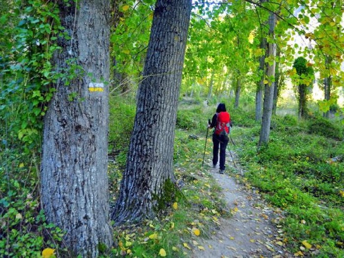
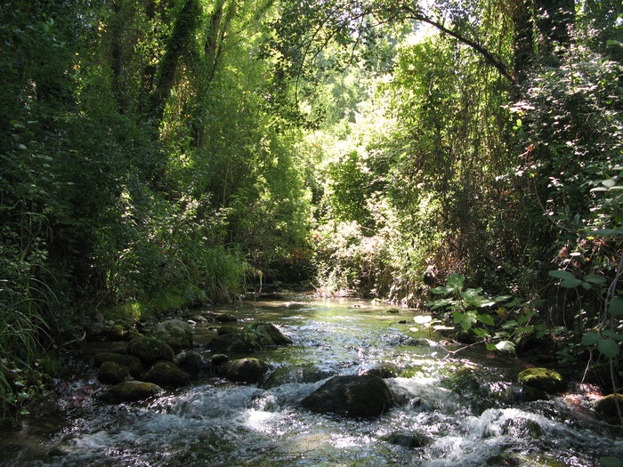
A little further on, the path starts. About 45 minutes after the start, the route turns south and begins to ascend moderately through a pine forest. The shadow will accompany you on the climb and, when you reach the slope, you will enjoy incredible views over the Segura valley.
Later, narrowing the valley, you will walk next to the walls that hang over the river. If we are lucky, maybe you can see the lammergeyer flying over the area. After crossing the caves, approximately at kilometer 4 of the route, you will find a detour to the right that goes towards Charco del Humo.
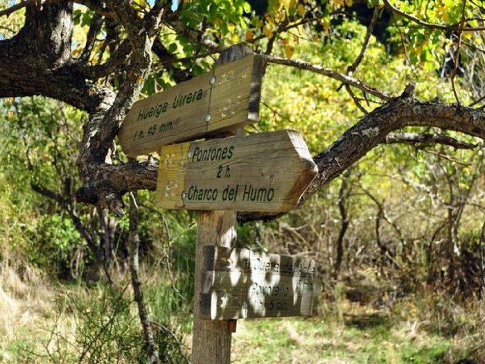
On the left, the route continues to the Cueva del Agua, end of the journey, which is reached in just 15 more minutes. This cave, crossed by a crystalline spring, is a clear example of the karst landscape that predominates throughout the Natural Park. The views over the Segura River will be a good reward for the effort made in the climb.
If you still have the desire, you can continue the ascending road to the village of Poyotello, exceeding 6 kilometers in total. From there, at over 1,400 meters of altitude, the views over the entire area are impressive.
ROUTE TO PURGATORIO WATERFALLS (MADRID)
Starting from Rascafría, 97 kilometers from the capital of the country, the route of the Cascadas del Purgatorio is simple but just as spectacular as other well-known hiking routes in Sierra de Guadarrama.
The road starts from the vicinity of the Paular monastery, 2 kilometers past the village. If you are a lover of history, you will be interested to know that this architectural jewel dates back to the 14th century, being the first Carthusian monastery of Castile, and in its interior there are authentic treasures, such as its alabaster altarpiece.
nteresará saber que esta joya arquitectónica data del siglo XIV, siendo la primera cartuja de Castilla, y que en su interior se guardan auténticos tesoros, como su retablo de alabastro.
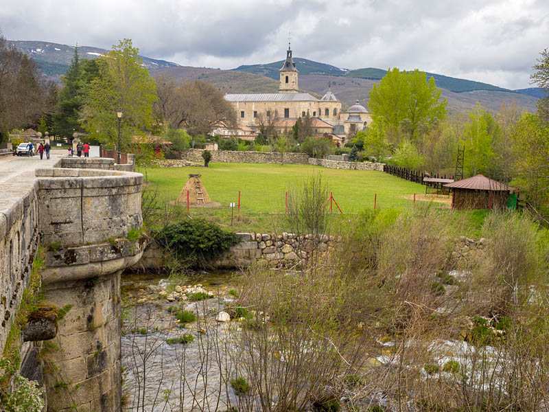
Monastery of Santa María del Paular and Puente del perdón on the Lozoya River.
It begins by crossing the ‘Bridge of the Forgiveness’, baroque work that owes its name to the express trials that were held there for the prisoners who led to the gallows. Next to the bridge there is a center where you can ask for information, although the signs that are found along the way make it impossible to get lost.
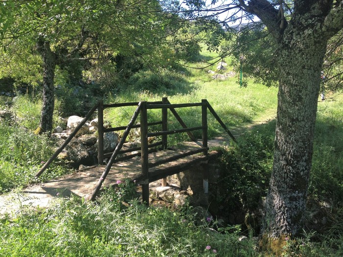
At about 1 kilometer, at the height of the recreational area of Las Presillas, the Lozoya River forms natural pools that invite you to have a dip. A plus to make this route in summer. You will continue walking among oak groves, a guarantee of shade at this time of the year, and you will begin to ascend to go up the river Aguilón, one of the Lozoya tributaries.
Later, the oaks give way to the pine forest, and the path goes through large rocky massifs where, with some luck, you can see flying over the black vulture. The last section runs between the cuttings of Majada Grande.
At 6 kilometers from the beginning you reach the Cascada del Purgatorio, which can be seen from a wooden platform in front of it. To return, you can return by the same path or go down the opposite bank of the Aguilón River; although, in this case, the shadow is smaller.
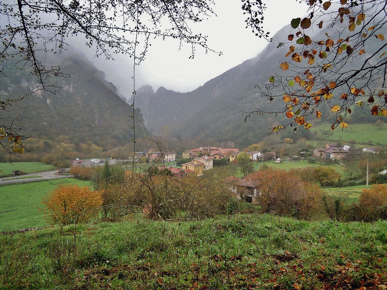
GREEN ROUTE OF SENDA DEL OSO (ASTURIAS)
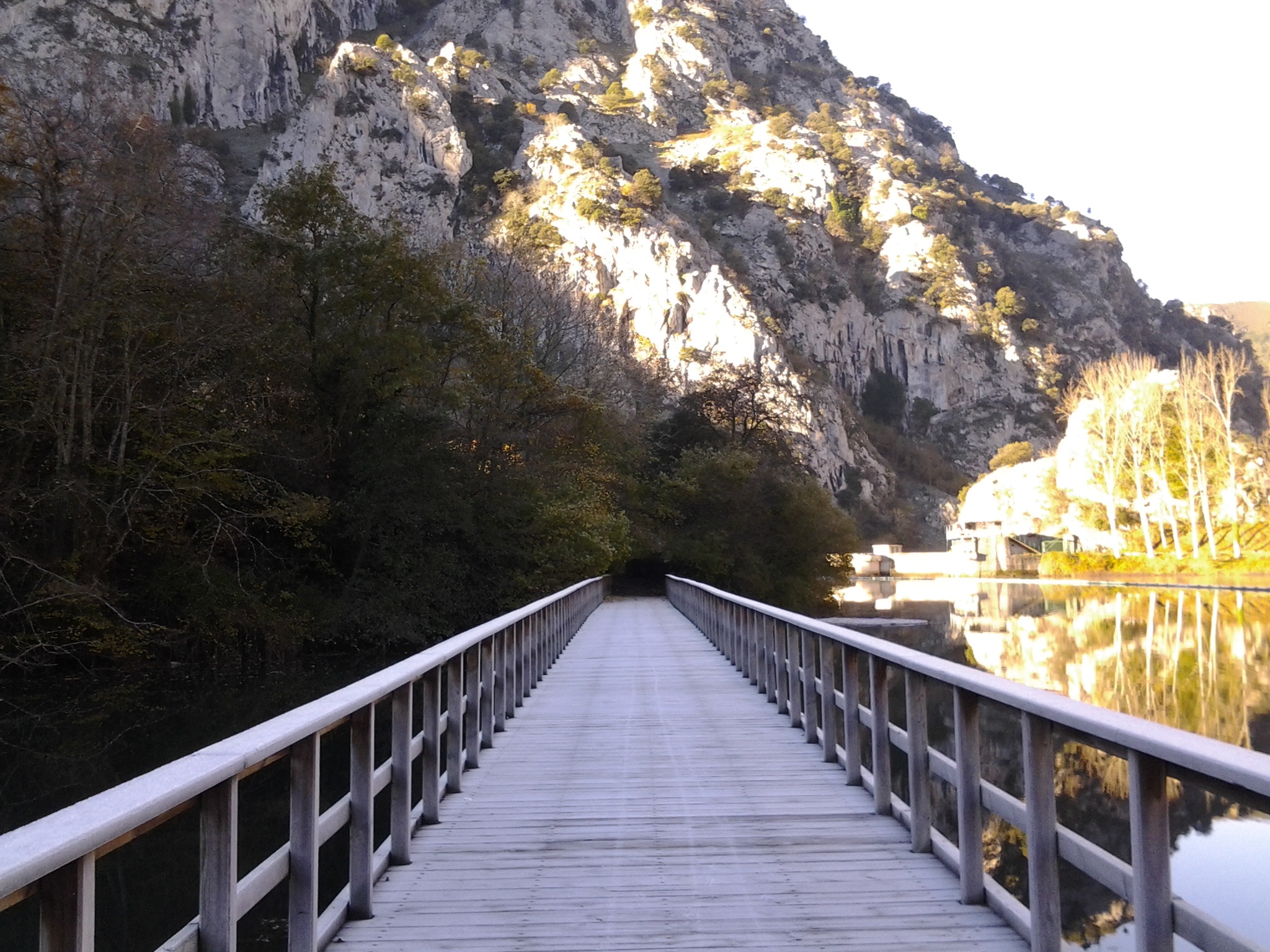
The Senda del Oso is one of the best known places for hiking in Asturias. It is a greenway with more than 40 kilometers of route that runs along old railroad tracks between the councils of Teverga and Quirós, crossing bridges, tunnels and some other surprise.
Despite its length, the good condition of the road and the possibility of dividing it into smaller sections make it a great option to travel with children and for people with reduced mobility. In addition, at both ends of the road it is possible to rent a bicycle to make the Footpath with pedals.
If you go from north to south, the beginning is in the village of Tuñón, where a sculpture of a bear welcomes you. The path follows the channel of the Trubia river to the south and, along the way, you will change several times of margin, saving the river through small stone bridges.
Shortly before arriving at Proaza, at kilometer 6 of the route, you pass through the recreational area of Buyera. There is the fence where the Paca and Tola bears live since they were rescued from poaching as young. In Proaza you can learn a little more about the brown bear in the Casa del Oso, home of the Brown Bear Foundation of Asturias.
About 5 kilometers past Proaza you will reach a fork. Here you must decide if you want to continue on the way to Entrago or to Santa Marina, passing by the Valdemurrio reservoir, where canoes can be hired. This means adding 14 kilometers to the route you already have.
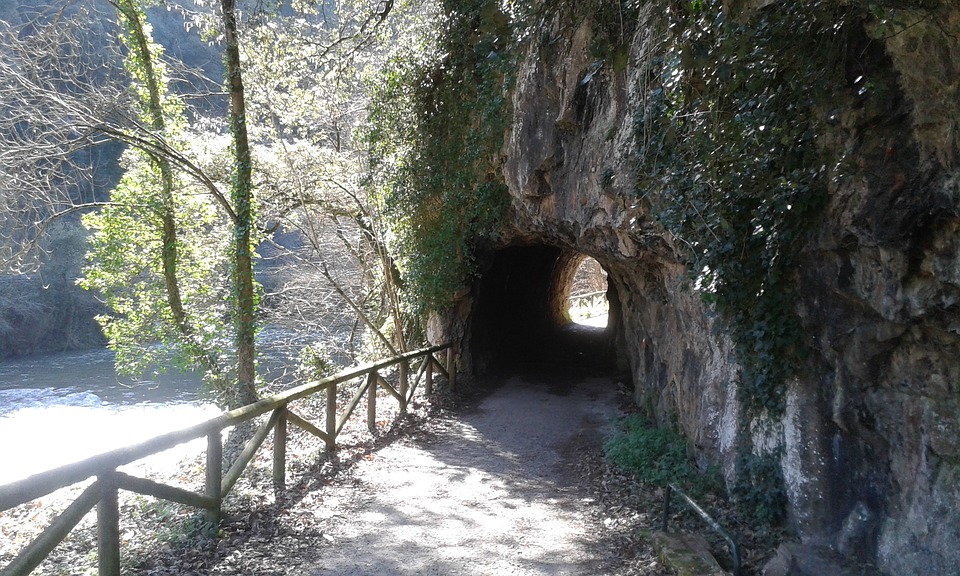
If you continue to Entrago, you will go into an increasingly rugged landscape. You will have to cross the gorge of Penas Xuntas and, later, Valdecerezales, both of great beauty. In this section, you must go through a lot of tunnels dug into the rock that, in addition to taking shelter from the sun, will give a touch of mystery to the adventure. When you get to Entrago, you will have traveled 22 kilometers.
In Entrago there is another recreational area and a bus line that you can use to return to the beginning of the route. If you still have not tired of walking, there is a last stretch of 9 kilometers from Entrago to Cueva-Huerta that goes into the Natural Park of Las Ubiñas-La Mesa.
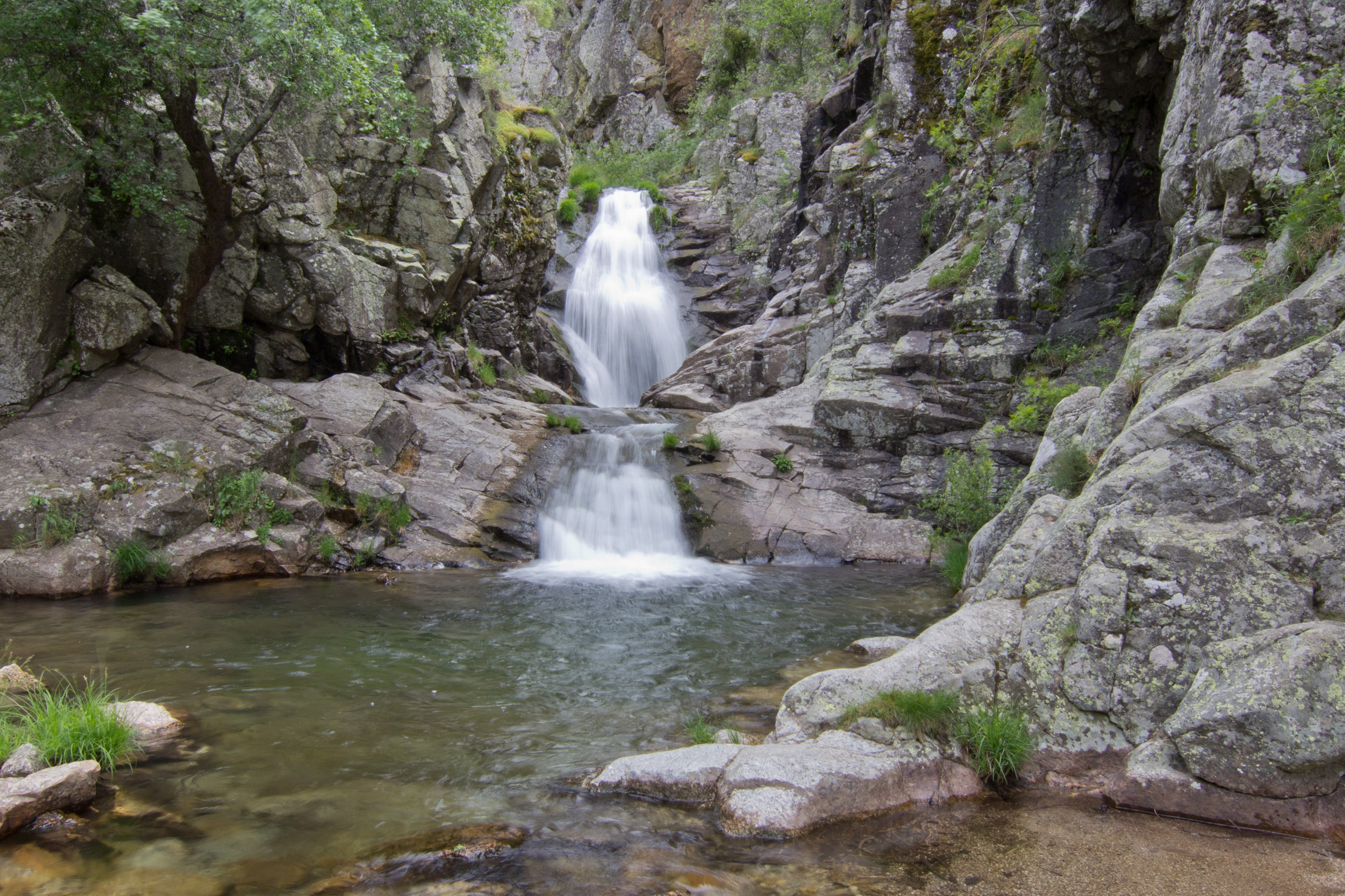
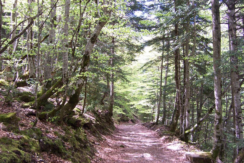
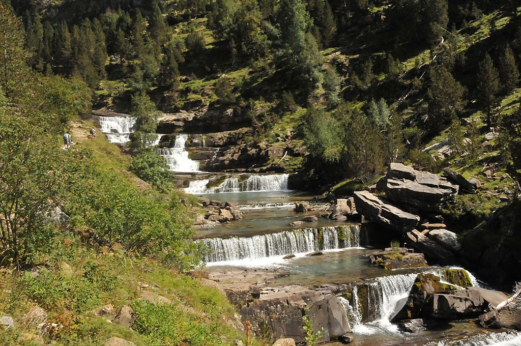
GRAS DE SOASO, FROM THE ROAD TO COLA DE CABALLO (HUESCA)/
The Cola de Caballo waterfall, in the Ordesa y Monte Perdido Natural Park, is one of the most popular places to see in the Aragonese Pyrenees. Although in the last section the route runs through open meadows, for two thirds of its route it crosses lush forests with constant shade. That gives us enough to make a good route of about 2 hours, with a finish at the Gradas de Soaso.
The tour starts at the Pradera de Ordesa car park, following the signs to Cola de Caballo. The track is well signposted. You will start ascending the river Arazas between forests and clearings, and, little by little, you will gain height until reaching the viewpoint of the Arripas waterfall.
At this point there is a detour that allows you to return to the Pradera de Ordesa on the other side of the river. Continue on the path on the left. You will go deeper into a forest more and more leafy and passing through other spectacular waterfalls, such as the Strait.
You will be aware of how the road gradually gains height while you immerse yourself in a beautiful beech forest. Although the leaves have not yet begun to obtain that ocher color characteristic of autumn, the sensation of magic and mystery that overwhelms you in these forests is equally unique at this time.
Before leaving the beech forest, you will leave behind, on the left, a detour that goes up to the Cotatuero circus. When leaving the forest the track narrows and runs in the shadow of the mountain. Soon, you will reach the Frachinal cave and, finally, the Sodaso stands. You will find several viewpoints to admire from different perspectives the succession of stepped waterfalls that reproduce a unique image.
If you want to continue to the Horsetail, you just have to continue through the valley, more and more open. It will be another approximate hour of road that, although equally beautiful, can be accused by the lack of shade during the summer.
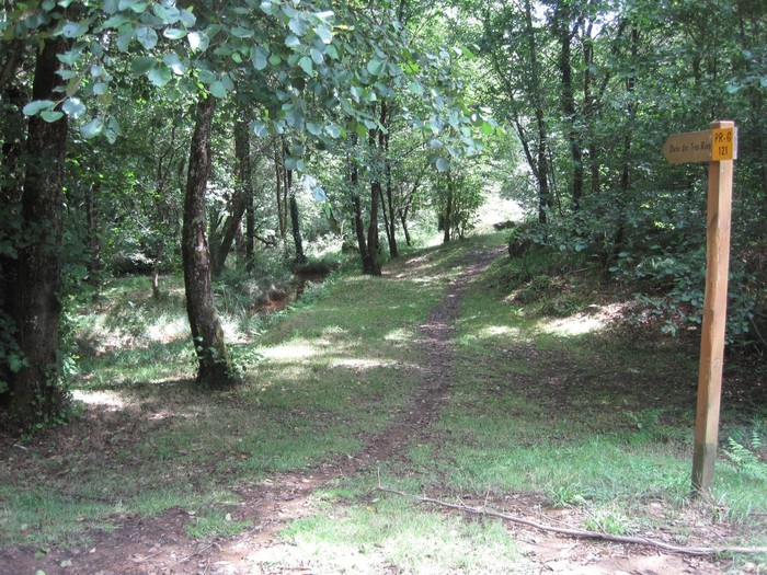
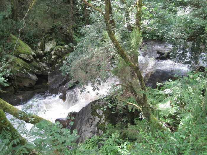
ROUTE OF THE THREE RIVERS (GALICIA)
If something characterizes this route, it is water. The path, well conditioned and signposted, runs all the time without separating from the banks of the three rivers that give it its name: the Ulla, the Beseño and the Lañas. This, together with the amount of shade you will enjoy during the tour, make it an ideal route for these last days of heat.
The road starts just in front of the recreational area of Santaya, in the municipality of Touro. Soon after starting, walking along the banks of the Lañas River, you will pass an old mill, one of the several you will see during the route. Years ago, these mills, already in disuse, enjoyed an intense activity among the neighbors of the area.
At approximately 2 kilometers, you will reach the Carballa mills (these have been rebuilt) and, 1 kilometer later, the waterfall of the Salto das Pombas, about 10 meters high. In this area, the road has been enabled with wooden stairs and walkways to save the unevenness and make it more accessible. You will first get an image of the waterfall from above, then go down to the river and see it in front.
After passing the waterfall, the trail starts a small climb up to the Beseño river. Afterwards, you will again walk along the banks of the Lañas River, crossing leafy forests of chestnut trees, pines and carballos. Later, the path will descend to reach the third river, the Ulla, which is well known for family rafting in Galicia.
In this area, you can see the remains of ancient «pesqueiras», stone constructions used to fish in the river since the time of the Romans. You will continue walking along the right bank of the Ulla River until reaching Basete Bridge, thus ending this beautiful route.
LA SAUCEDA PATH – ALJIBE PEAK (MÁLAGA)
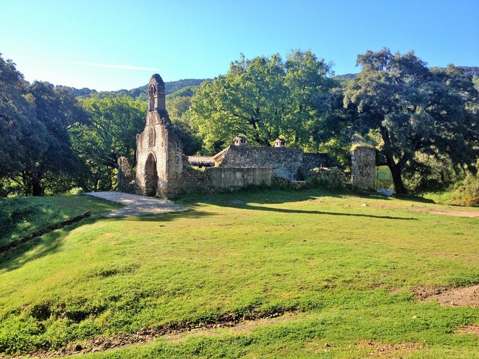
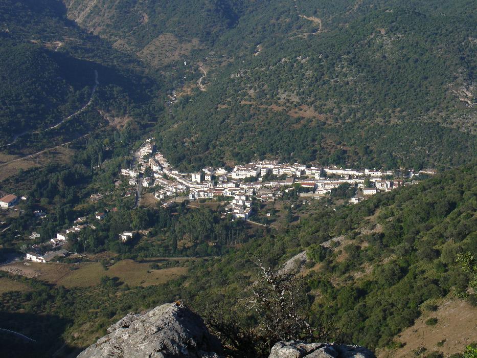
The place of La Sauceda is one of those places where history has made a dent in such a way that time seems to have stopped, and a feeling of awe invades who visits it. In a truly spectacular natural environment, it is not surprising that this trail is one of the favorites of visitors to the Alcornocales Natural Park.
The route begins in the recreational area of La Sauceda, which is reached by the CA-8201 road from Jimena de la Frontera. The trail goes into a forest of cork oaks and gall oaks to go up the Pasadallana stream valley.
After passing Molino del Medio, the road approaches the village of La Sauceda, whose hermitage hardly keeps the walls standing. This place of difficult access was a hiding place of many supporters of the republic during the Civil War and suffered attacks by the Francoist troops. That is why a place that is admired with regret, despite the beautiful surroundings.
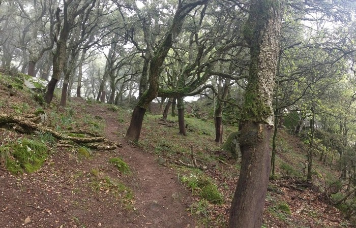
The road turns now to the left, following a sign that reads «Path of the Peak of the Aljibe» to enter again in the forest. The fog and shade cause this effect of subtropical forest where new species such as holly and oak trees appear. Later, the path begins to ascend through thickets through a steep slope which, if it has rained, may be muddy.
As you ascend, the views become impressive. When you reach a small clearing, the slope decreases and the trail goes into a less dense forest. On the right, you can see the rock mass that separates the provinces of Cádiz and Málaga. Here you will have to cross a fence that gives access to the highest peaks of the sierra. You will then go through the Queen’s Pool, where it’s said that Isabel La Catolica used to bath.
Now you only have to reach the Aljibe peak, at 1092 meters above sea level, and enjoy the views of the Natural Park and the birds of prey that fly over it, before setting off on the way back.
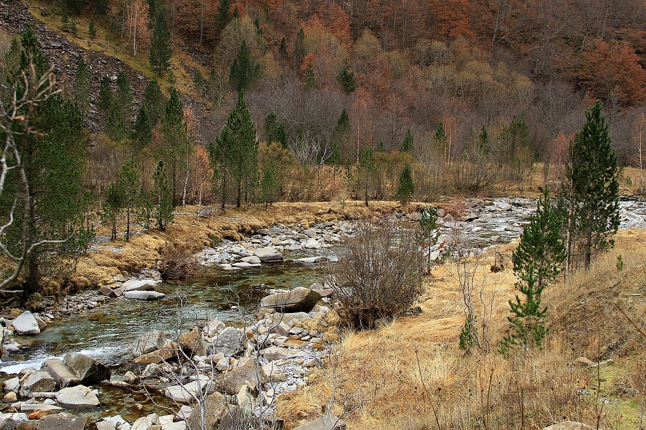
ROUTE OF ZABALETA, IN THE JUNGLE OF IRATI (NAVARRE)
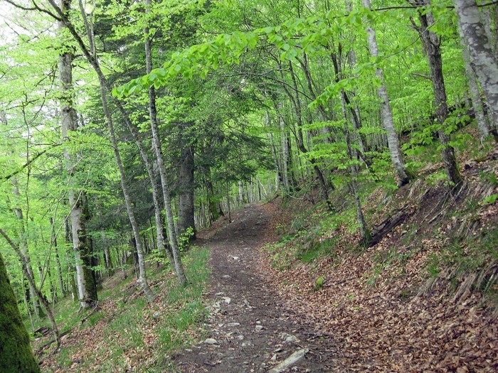
La Selva de Irati is one of the best-preserved beech woods in Spain, together, for example, the beech forest of Tejera Negra. In autumn, the color of the beech leaves is spectacular. But even before this arrives, it is possible to enjoy its trails, well signposted and well cared for, under the pleasant shade that the trees project.
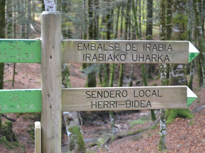
One of these routes is Zabaleta, which starts at the Casas de Irati reception center, which is accessed by the NA-2012 highway from the town of Ochagavía. The path, marked as SL NA-63A, emerges right next to the information booth and is very well marked throughout the journey.
You must walk about 300 meters on forest track before turning off to the right along a path that ascends little by little, entering a magnificent forest. There, the sensation of calm and serenity will instantly overwhelm you, making you connect with nature in a way that you did not think it was possible.
The path goes around the hill of La Vieja and offers us beautiful views of the Irati river valley before starting to descend again until reaching a new track, which coincides with the GR-11 long-distance trail. A kilometer and a half later, you will take the detour to the left that leads to the forest house, now in disuse.
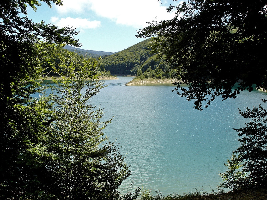
The house, located at the end of the Irabia reservoir, marks the midpoint of the route, 4 kilometers from the beginning. You will find a fork that will give you the choice between skirting the reservoir (path SL NA-53C) or return to the starting point; Of course, on a different path.
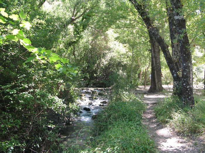
The return combines stretches of path between beech trees with stretches along the banks of Irati River. The murmur of the water next to the songs of the birds help to recreate that mystical atmosphere that accompanies you from the beginning. Finally, there’s a return to join the track of the GR-11, without further complications, to Casas de Irati.
PATH OF MAJACEITE RIVER (CÁDIZ)
In the province of Cádiz we find one of the places in Spain with the highest rainfall rate. This gives rise to an abundant and dense vegetation that even on hot days allows a visit to Sierra de Grazalema.
The route of the Majaceite River joins the towns of El Bosque and Benamahoma, and is one of the most beautiful and simple ones that can be made in this trip. To get to the start point, you have to follow a path that appears in front of the El Bosque bullring, next to Las Truchas hotel. At 600 meters we will find the sign that symbolizes the beginning of the route, in the vicinity of the hostel.
The path, practically flat, runs parallel to the river under the pleasant shadow of the riparian vegetation. Among other trees, you can see elms, willows and ash trees. The river water that accompanies you is crystal clear and invites you to take advantage of these last days of heat to have a dip.
After passing a small dam, you get to some wooden walkways that allow you to save the area without getting wet in the times when the rain usually floods the land. Always following the river, you reach the Molino de Arriba, where the vegetation begins to open giving place to orchards and meadows.
The clearing lasts little, because again you will be surrounded by a gallery forest that provides constant shade. You will find several posters that inform about the fauna that is found in the environment, among which the otter stands out. The ground becomes more irregular, although not difficult at all, and you will have to climb steps made of stone or wooden steps.
The river is rough in this section, with small jumps and waterfalls that add attraction to the route. You will pass through several bridges, changing over and over again from the shore, and you will not be able to resist taking the camera to immortalize some of these beautiful corners of this mountain range.
Once again, you reach an open field next to the river and the remains of another old mill that is barely standing. In the last section, fruit trees and orchards are again visible. The route ends with a wooden platform that leads to the parking lot at the entrance to the town of Benamahoma.
ROUTE OF SIERRA MARIOLA COVES (ALICANTE)
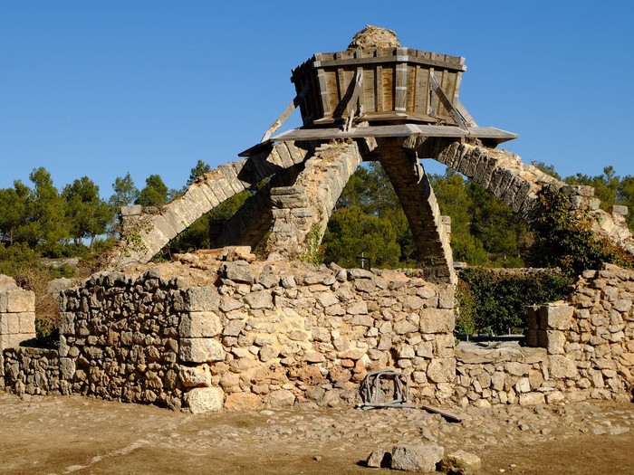
Sierra Mariola Natural Park occupies one of the most charismatic mountain ranges in the Valencian Community. In addition to great flora and fauna, we find vestiges of human settlements from immemorial times. One of the representative constructions of this history are the snowfields or cellars, in which the snow was stored and then taken out in the form of blocks of ice.
This route runs between trees to find the different caves that are preserved in the mountains. A journey that mixes history and ideal natural environments for us to enjoy a last adventure before returning to the routine.
The trail starts in the recreational area of Agres, where you can leave the car. The area has tables, a fountain and even a restaurant; things we can enjoy when finishing our route. For a few minutes, you will have to climb away from the village until you reach the lower part of Agres sanctuary, which you will skirt to turn to the right.
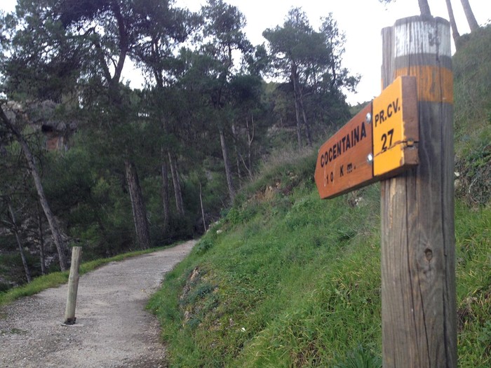
Follow the path signposted as PR-CV 27 and continue climbing to enter the Barranc de l’Assut. You will zigzag along the edge of the mountain, crossing constant formations of Aleppo pine which provide a pleasant shade. Just before reaching the refuge of Montcabrer we find the first spot, Cava del Teix, which is located on the left of the road, although a little hidden by the ivy and weeds.
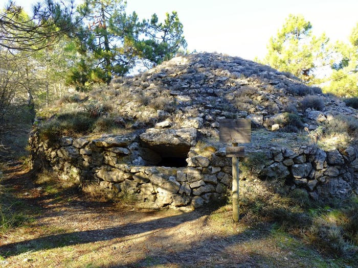
After the refuge we also find Cava de l’Habitació, more visible and in better condition. Then turn right to take a forest track that descends towards Gran Cava, the most famous mountain. It differs from the other mountains by its hexagonal shape and because of the 6 stone arches that once held a dome above it.
Continue on the forest track in a westerly direction to reach Cava del Buitre, which is hidden among pine forests. It is the smallest of the road but, in return, stands up in a very good state. In the following curve, you must turn to the left to continue on a path that leads to Cava de Don Miguel, the last one of the route.
Finally, it is only necessary to return to the starting point, this time taking the PR-CV 104 trail, which leads to Zamorano refuge. The descent occurs again, for the most part, between pine forests. Once in the refuge, the path turns to the right and concludes in the recreational area we had in the beginning.
Trails, greenways, quiet family walks or authentic trekking routes… Regardless of their length and difficulty, they all have something in common: they are designed to walk in the shade.


La Sauceda is indeed a magic place to benefit from autumn landscapes in South Spain. Another epic trekking route in Andalusia for me is anyone in Sierra de Aracena, with golden chestnuts tree forests. There you can also hike a 100 km trekking tour challenge. In this link above, you can see the 5 best hiking routes in Sierra de Aracena. For me, the best one is the one that climbs onto mount San Cristóbal:
https://trekkingspain.eu/100km-trekking-tour-challenge-in-aracena/
ceda is indeed a magic place to benefit from https://resumecompaniesreview.com landscapes in South Spain.
In your article, you got the best ideas to spend summers in Spain. Also, we bring you a fantastic offer with surprising Mobile Laser Tag Game in San Diego CA. We have different laser tag game options like splitting teams into various players.