The Carretera Austral: an Adventure in the Confines of the Chilean Patagonia
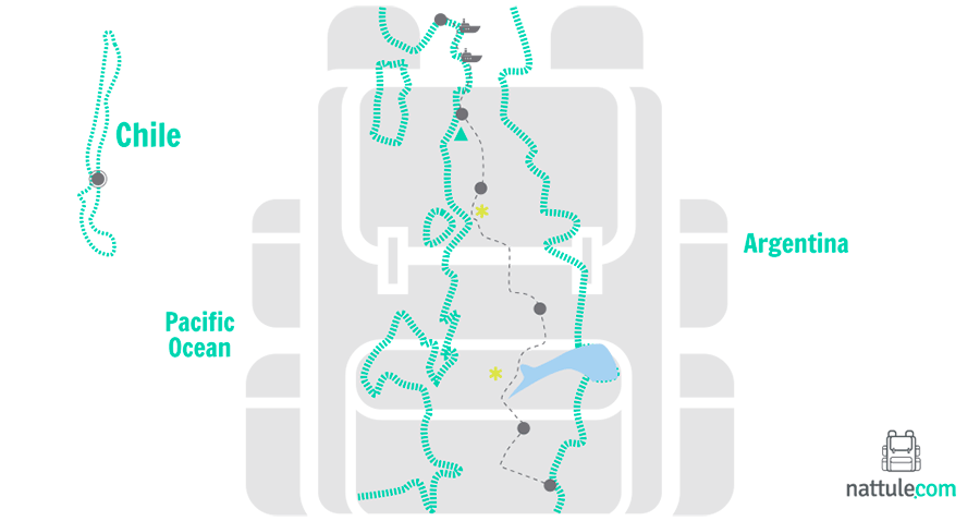
The Carretera Austral is like drawn by a knife in southern Chile. It goes through one of the most breathtaking sceneries in the world: Patagonia. In its 1,240 kilometers, asphalt cohabits with dirt tracks. The route is dotted with ancient forests, fjords, active volcanoes, lakes and rivers of turquoise waters, plus extensive national parks and reserves.
The journey begins in Puerto Montt (Los Lagos region) and ends in the town of Villa O'Higgins (Aysén region). You can cross it by car, bus or bicycle, and even hitchhiking, a common practice in this area of South America. In addition, in several points you will have to use bars to continue.
If you go without a car, it is highly recommended to get information about the schedules of the few bus lines that circulate in these areas. Bringing a tent with you to rest while waiting for the next bus will make things easier in these latitudes where life goes slowly. The weather is unpredictable, which forces you to be predictable: make sure you take a raincoat with you.
Apart from the weather, every kilometer in this Chilean adventure is wonderful. There is only a few places on the Earth like this, where you can make a similar variety of nature-related activities: horseback riding, hiking, climbing volcanoes or descending in spectacular rivers are just some examples of what this trip offers you.
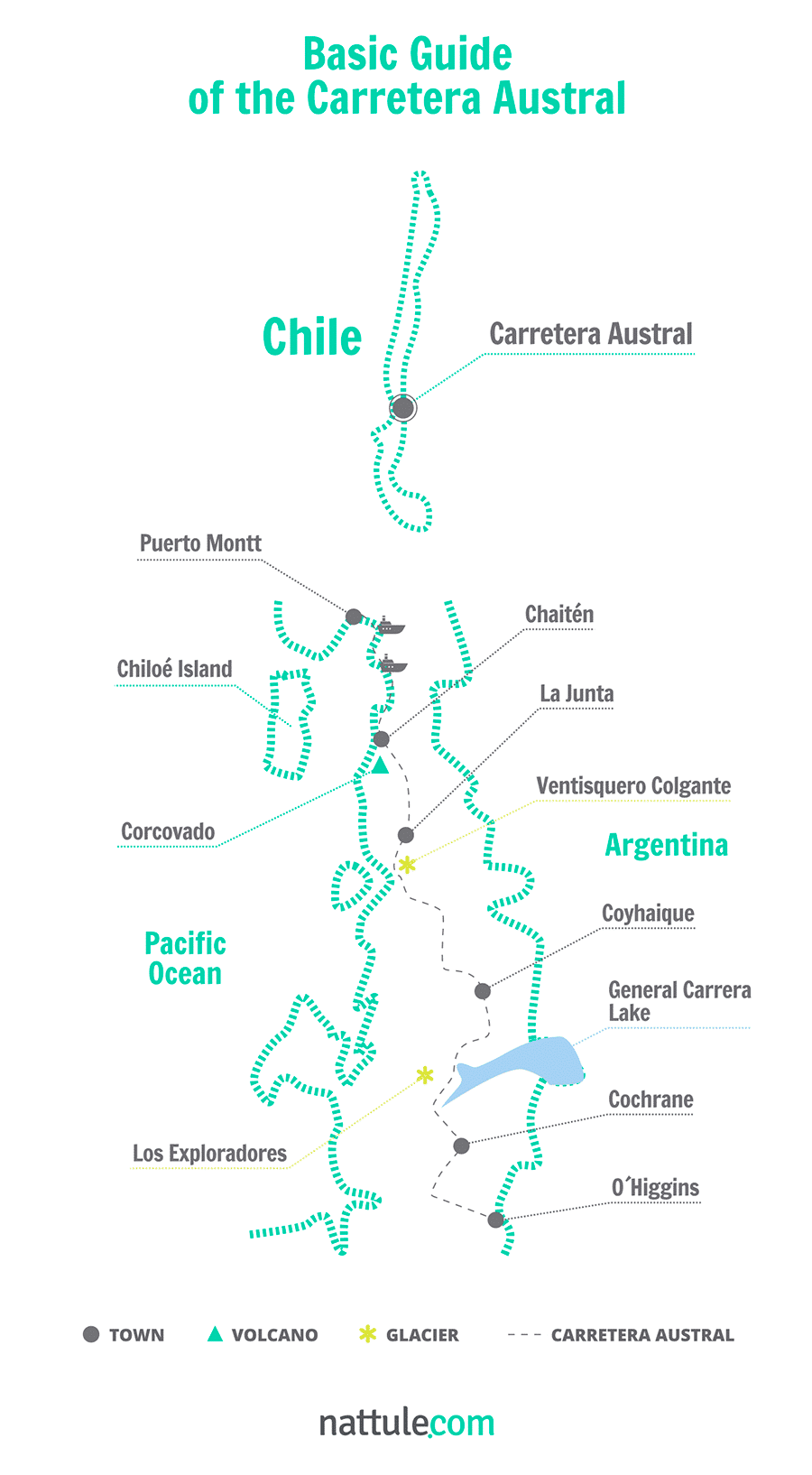
Nattule describes the 5 sections in which usually this spectacular route is divided:
SECTION 1. From Puerto Montt to Chaitén: The Land of Volcanoes
In this first section we travel 205 kilometers to reach the town of Chaitén. Along the way, you must take three bars.
Puerto Montt is the capital of Los Lagos region, the departing location to start the tour of the Carretera Austral, also called Route 7. First, you will head south on a paved road that runs along the coast towards Pelluco.
In the province of Llanquihue you will find the first attraction of your journey, the Alerce Andino National Park, located between the towns of Puerto Montt and Cochamó. It's about 20,000 hectares of forest of larch, a highly prized and endangered native tree in southern Chile. As for fauna, there are species such as pumas, Pudu, the güiña and mountain monkeys. You can explore its network of trails and visit the impressive waterfall of the Chaicas River.
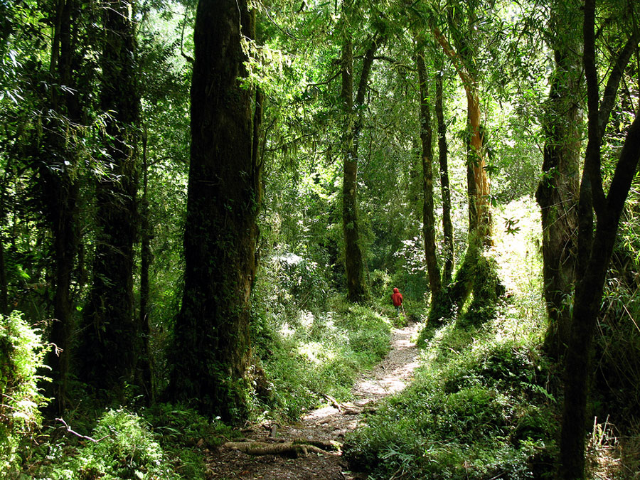 Alerce Andino National Park
Forty-six kilometers away, you will find Caleta La Arena, the departure location to cross the Reloncaví Estuary. You'll have to take a ferry to Caleta Puelche, which takes about 30 minutes. This ferry does not require advanced booking and embarks on order of arrival. You pay on board. Once in Caleta Puelche, there is 10 kilometers of gravel road to reach the small town of Contao on the banks of Reloncaví.
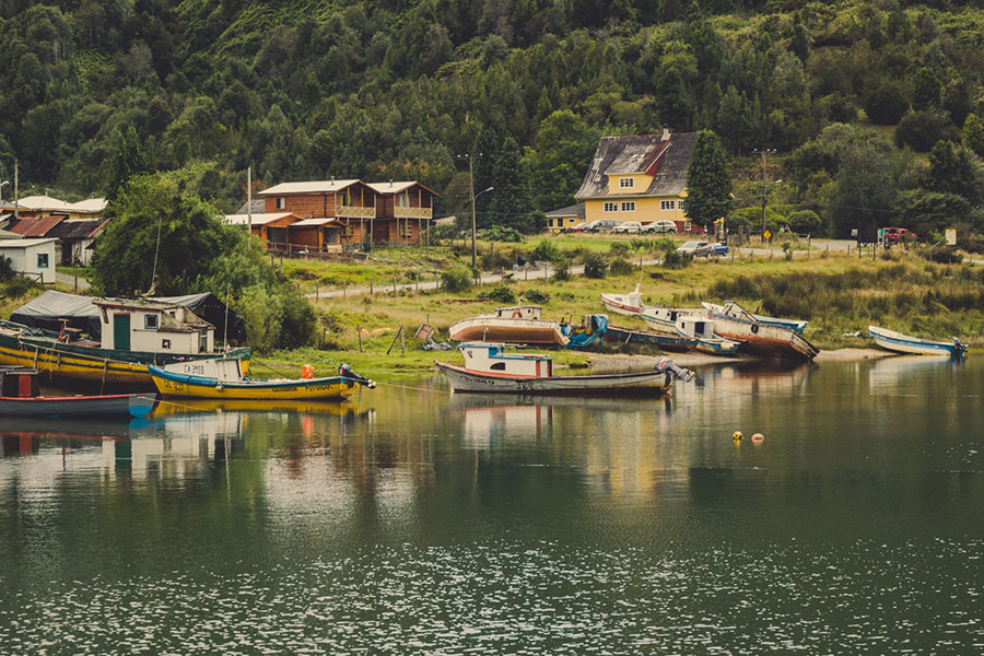
The journey continues in the small fishing villages like Gonzalo or Manzano. In the Pichicolo Fjord, you can relax at the hot springs located just a few kilometers away. Later, you will arrive to Hornopiren, the communal capital which has several restaurants and accommodation options where you can taste the local cuisine. There you will have to make the second transfer.
After crossing the Negro and Blanco Lakes, you will reach the beach of Santa Barbara. If you love water sports or if you just want to cool off you must stop at this beautiful beach. From Cuesta Fandango you will see the Corcovado Volcano.
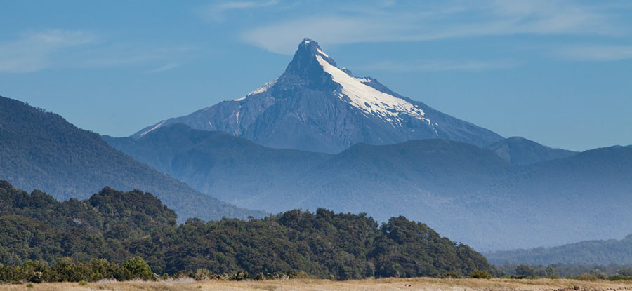 Corcovado Volcano
The top of the volcano has only been trodden by experienced mountaineers, given the difficulty of climbing through the austral forests and its difficult terrain, especially in the final stretch. However, mountain lovers will enjoy being at its feet and admire its majestic summit.
At the end of the journey we find Chaiten. Don't expect a big city. This former capital of the province is now almost abandoned, since in 2008 the volcano swept away the population. However, you can get basic supplies and hosting services, as the village is under reconstruction.
If you have enough time, do not hesitate to visit the island of Chiloé. A barge that travels from the port of Chaitén, two days a week, will take you there.
 Chiloe National Park
SECTION 2. From Chaitén to La Junta: World Paradise for Rafting
This second section is about 150 kilometers, most of them in dirt tracks. From Chaitén, about 25 kilometers to the south, the road will take you to the hot springs of Amarillo, a conducive place for a stop along the way and where it is also possible to find camping areas, hostelries and cabins.
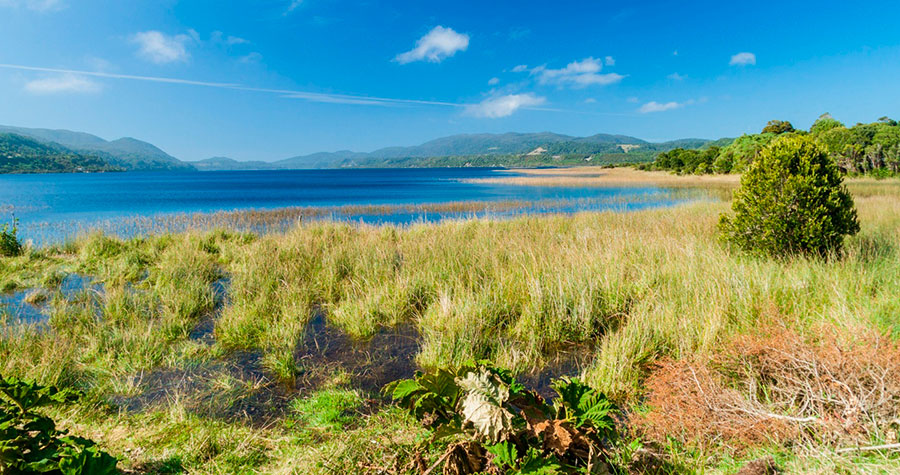
If you keep heading south, you will reach the shores of Lake Yelcho. This beautiful lake attracts fishermen arriving from various parts of the world in search of trout and other salmonid species found in its cold waters. On the banks you will find many quaint wooden lodges where you can spend the night or stay a few days.
 Lake Yelcho
Leaving behind Lake Yelcho you will arrive to Board, a town that stands as the northern gate of the Aysen region. There you'll have lodging, restaurants and inns. This town will also be important to fuel up your car. Here you can find internet access, telephones and tourist information.
This population is known as The Meeting Town, because here is where the most important rivers in the area join, the Rosselot and Palena Rivers. It's also where several paths merge: going east we reach Lago Verde, to the west is Raúl Marín Balmaceda and Puyuhuapi on the south.
At these crossroads at the border between Chile and Argentina, the rivers are known for their spectacular beauty and crystal clear waters. They are world renowned for kayaking and rafting. This is the case of Futaleufú River, a place of pilgrimage for water sport lovers.
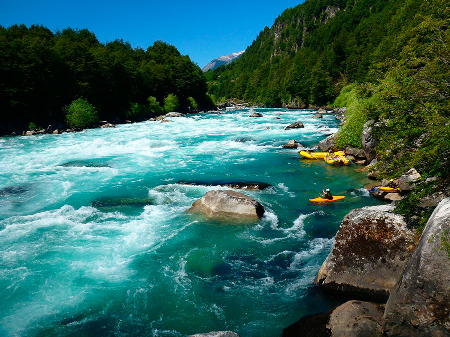 Futaleufu River
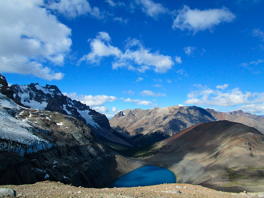
SECTION 3. From La Junta to Coyhaique, Queulat's Heart
From La Junta, the road will take you towards Puyuhuapi. On your way you will find the Risopatrón Lake, the largest lake in the Queulat National Park, an Andean paradise of over 150,000 hectares and one of the least disturbed areas of Chile. In the Queulat mountains there are majestic oak forests of Magellan or coihue and white oak that make this location unique.
After about 45 kilometers you will reach the village of Puerto Puyuhuapi, located at kilometer 192 of this southern crossing. You will be amazed by the Central European architecture of the houses, imported by early German settlers, and beautiful carpets that are made by craftsmen and possible to obtain from local markets. It is an ideal place to set up your camp, recharge your batteries, fuel the car and stay a couple of days doing some sightseeing.
 Puerto Puyuhuapi
After leaving Puyuhuapi you must go towards the beautiful valley of Ventisquero River, a little known place that hides another treasure of Queulat National Park: an ancient glacier that is located between two large rocky masses. When melting, waters flow off to a cliff. When cold weather arrives, the waterfall crystallizes forming a large ice tongue. There is a network of well-marked trails that take you to the moraine and the Hanging Snowdrift. You must not skip the path of the Enchanted Forest, one of the most beautiful forests of Queulat.
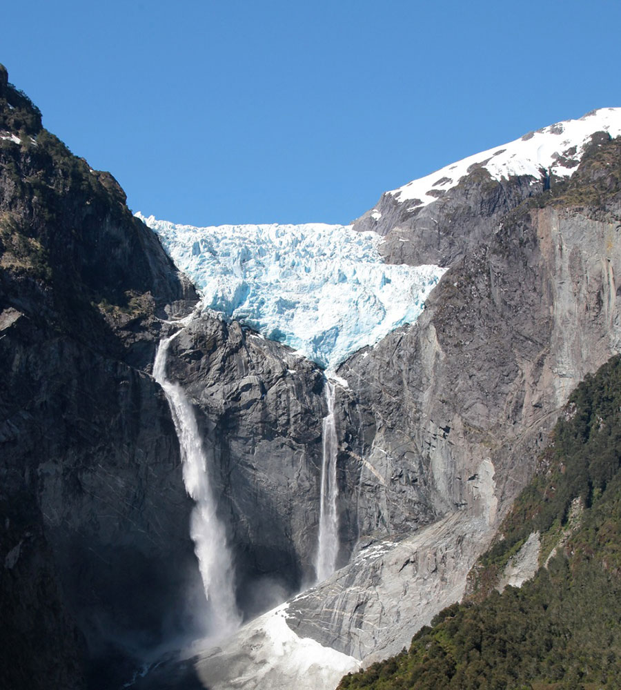 Glacier in Queulat National Park
Further south, the city of Puerto Cisnes, one of the major coastal cities in this area, and the majestic river bed of the Cisnes River are some of the attractions you should see.
From Puerto Cisnes, you will reach Las Torres Lake National Reserve and Mañihuales. Shortly after, you will have to choose between two options: to continue the original path that goes straight from Villa Ortega to the capital Coyhaique or take the detour to Puerto Aysén bordering the Simpson River Reserve towards the capital.
 Simpson River National Reserve © José M. Moya
The native term Coyhaique means camp between rivers in the language of Tehuelche. Since you will be tired when arriving there, we recommend that you take time and enjoy yourself in this beautiful and peaceful town and, if you get a chance, visit the San Rafael Lagoon and the mountains of Ñirehuao.
SECTION 4. From Coyhaique to Cochrane, the Glacier Province
The capital of the region of Aysén, Coyhaique, divides the southern road into two halves: north and south. The northern area has a greater amount of vegetation due to the frequent rain and increased number of human settlers. The southern area is different, but spectacular.
As you travel kilometers towards the southern edge of the world, you'll notice that the terrain becomes more inhospitable. The forests give way to the southern steppe, the wind rises with increasing force and human presence is progressively reduced. There you will have a sense of calmness, diving in a secluded place, away from the hustle and bustle of big cities.
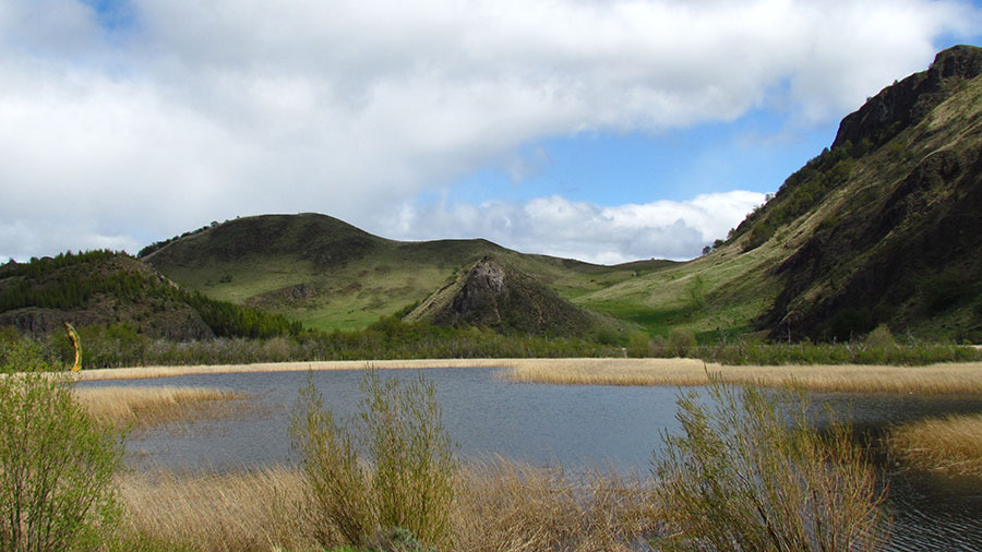
This stretch of 334 kilometers has countless protected areas of high environmental and tourist attractions, as well as rivers, lakes and suitable recreational fishing ponds. The first one you will find is at only 7 kilometers away from Coyhaique. The Foitzick Lagoon, surrounded by reeds and marshland, owes its fame to the so-called Wall of China, a rock shaped wall created by a solidified lava flow.
 Foitzick Lagoon
After 60 kilometers of paved road, you will reach the Cerro Castillo National Reserve, a place of stunning beauty. In its nearly 180,000 hectares highlights the presence of plants such as ñire, lenga, ciruelillo, caulk and chaura. Also animals like huemules, which is a kind of characteristic endangered deer of the Aysén region.
However, its main attraction is the massif of singular peaks covered with snow throughout the year, inviting you to take walks and excursions. You can hire specialized guides at the villa Cerro Castillo, located opposite the massif. This small picturesque village of just 400 inhabitants, has accommodation and all basic facilities.
 Glacier lagoon in Cerro Castillo © José M. Moya
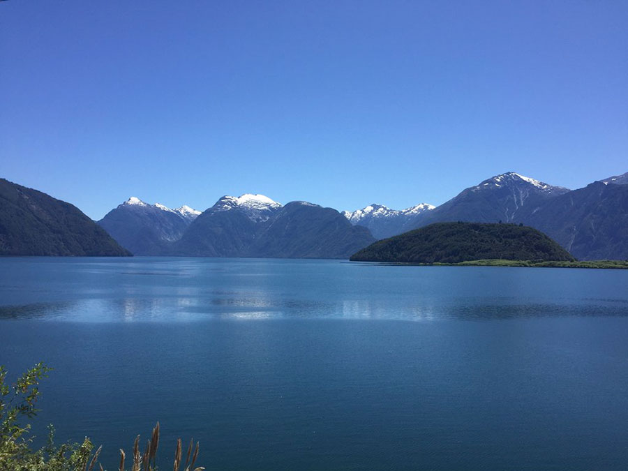
The road continues on the banks of the Murta River to a junction with a road leading to the picturesque village of Murta Bay, located on the northern shore of Lake General Carrera. This is the largest lake in Chile and the second in South America, after Titicaca. Murta has inns and lodgings, food shops, first aid, telephone and supermarkets.
 Lake General Carrera
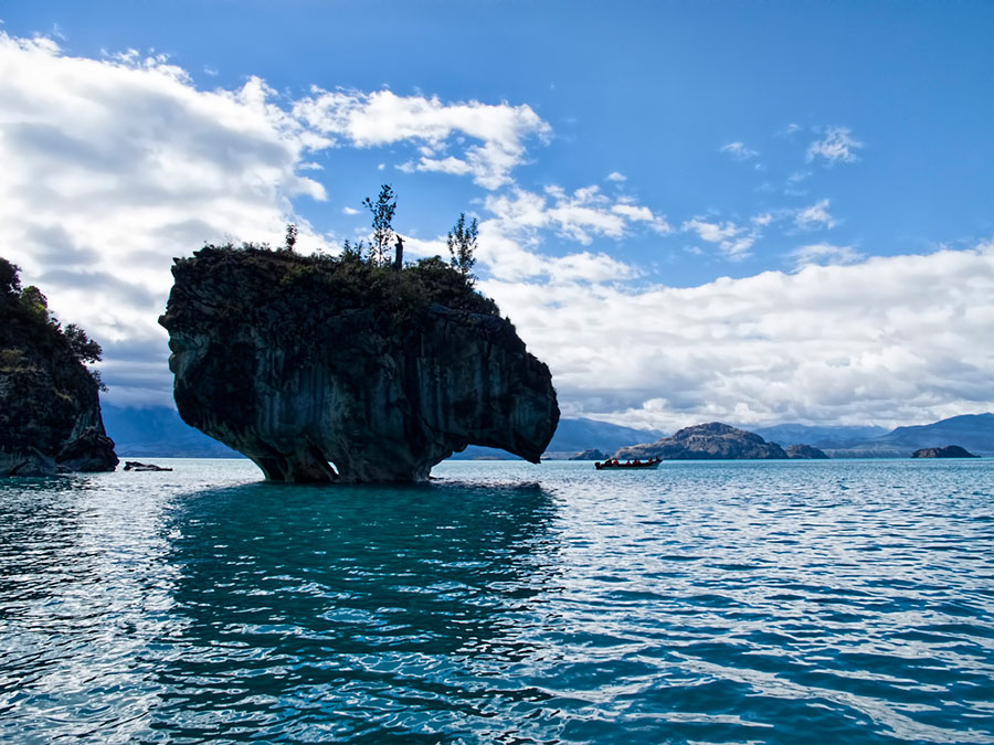
From the junction to Bahía Murta, in about 30 minutes, you will reach Puerto Río Tranquilo. The main charm of this town is that from here depart all the boats to the Marble Cathedrals, amazing rock formations emerging from the depths of this huge and beautiful lake. Every hour there are boat trips from the port, so there is no problem for boarding. Sunset is the best time to visit them.
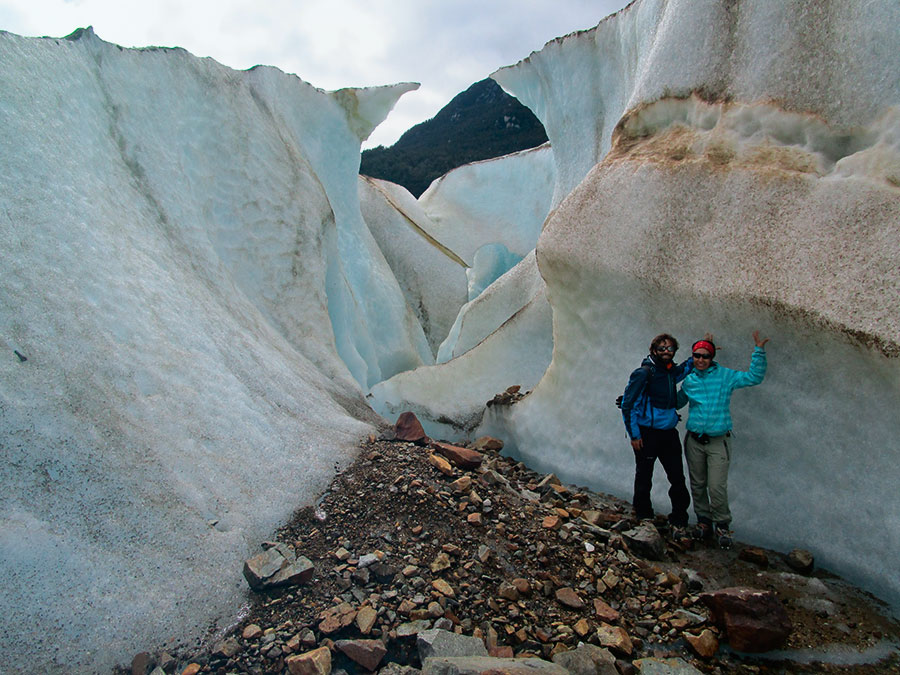
If you're bold you can also take a trip to Los Exploradores Glacier, although it is mandatory to go accompanied by a guide. You will find several possibilities to hire them in the same city. Cramping by the moraine of the glacier, entering ice caves and marveling at the view of the highest mountain in the Chilean Patagonia (Mount Valentine) is an unforgettable experience.
 The Glacier Explorers © José M. Moya
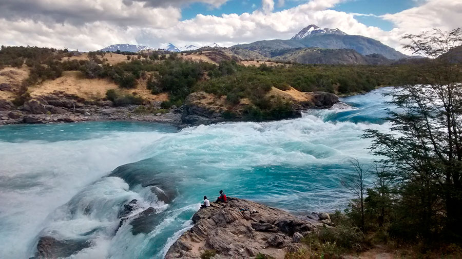
Later, you will find a small detour that leads to the village of Puerto Bertrand, a picturesque village nestled in an area of unique beauty on the lakeshore of a lake with the same name and surrounded by mountains and forests of lenga. This is the area of birth of the powerful Baker River, the largest river in Chile. Its turquoise waters are excellent for rafting. You should visit the spot where the river meets the Nef river course, the contrast created by the mixture of both waters is indescribable.
 Confluence of Rivers Baker and Nef © José M. Moya
Finally you'll get to Cochrane, capital of the province of Capitan Prat, also known as the Glacier Province. Cochrane is one of the supply centers and service centers of the south of Coyhaique. Around this town there are attractions to visit, such as the National Monument Paso San Carlos and Tamango National Reserve, where you can do some excursions to watch huemules and other species of Chilean fauna.
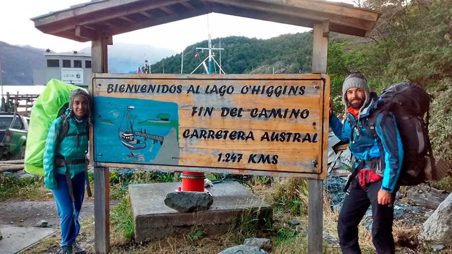
SECTION 5. From Cochrane to Villa O'Higgins: the Edge of the Border
Cochrane is the last settlement in southern Carretera Austral. If you need to withdraw money or buy supplies, this is the right place. You are about to delve into the final leg of your journey, the most inhospitable section of all your tour. Your ending point is near Villa O'Higgins, a town with colorful houses like a typical village of The Truman Show movie.
From Cochrane to Caleta Tortel there are 128 kilometers of unparalleled beauty. You'll go over protected wilderness areas near the village, where you can see the Esmeralda, Chacabuco and Vargas Lakes, and then bordering the Baker River to its delta. Right there is where Caleta Tortel, considered one of the most beautiful towns in the world, is located.
 Caleta Tortel
This Patagonian town can only be explored on foot. Its streets have been replaced by beautiful wooden footbridges built with cypress of Guaitecas (endemic of Patagonia), which led to its declaration as a Typical Area. The peculiar smell coming from the wood of these trees and that permeates the whole area will impact you. Another of the attractions of Tortel are the numerous hummingbirds flitting in search of food in the wooded areas of the town.
Once you pass Caleta Tortel, you should follow towards the Michel fjord, where Puerto Yungay is located. There are free barges, that take travelers on a journey of about an hour to get to Rio Bravo. After disembarking, you must follow the journey through a road flanked by an abundant native forest of pine, oak and lingues.
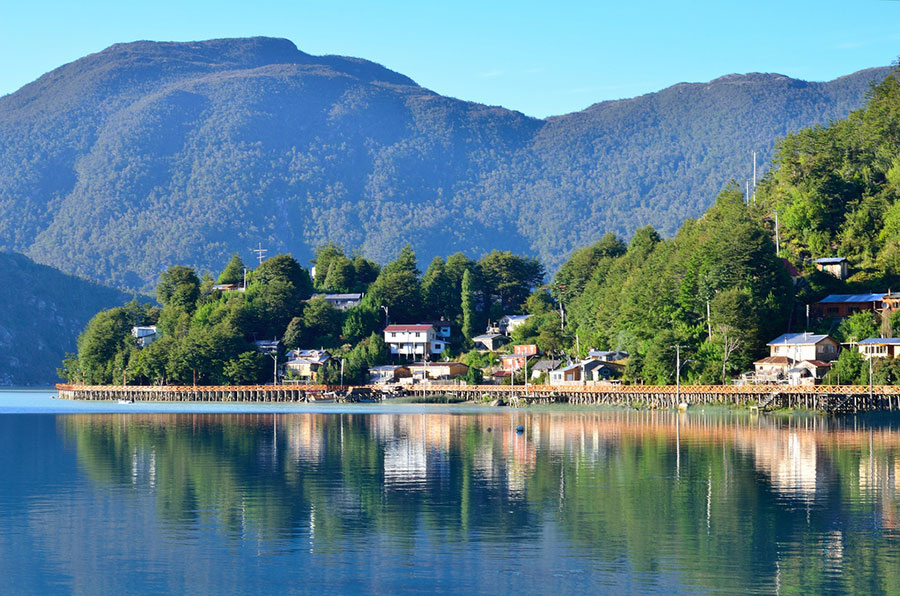
The last section is a distance of 100 kilometers to Villa O'Higgins. This nice little border town, located beside the lake of the same name, marks the end point of the Carretera Austral.
 End point of the Carretera Austral © José M. Moya
O'Higgins lake, located between Chile and Argentina, is one of the largest lakes of Patagonia. With more than eight arms, fed by snowmelt from the glaciers of the Southern Ice Field and the Mayer River, which flows near Villa O'Higgins. From Puerto Bahamondes, 7 kilometers away from the village, go hiking to the glacier O'Higgins or Candelario Mancilla, better known as the crossroads Dos Lagos, which communicates by land with the Argentinian town of El Chalten.
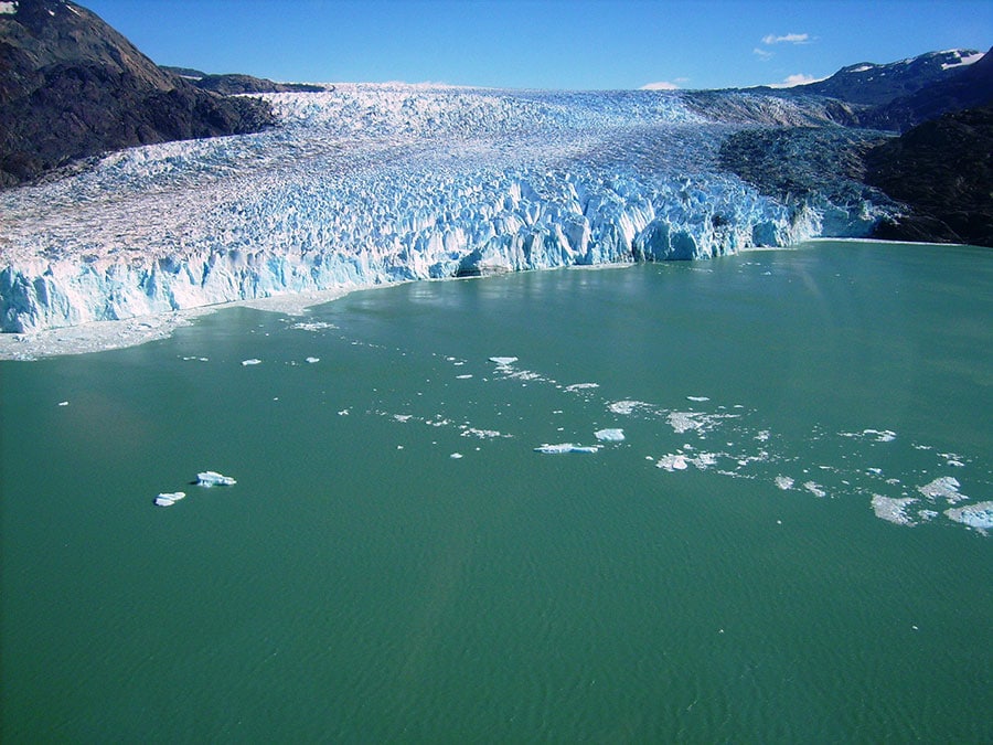 Glacier O'Higgins
[hr type=»line»]
Patagonia is not to be photographed, it has to be lived. Paris is something else. The Eiffel Tower is an accomplished model. In the Carretera Austral not any picture would capture in the right perspective the calm lakes, wildlife bravery, the transparency of the sky. Some people prefer the memory of the kiss to the kiss itself, but if you're not among them, Chile awaits you.
[hr type=»line»]


Explore effortless travel with Airport Transfer DFW – the dependable answer for consistent airport transportation to and from Dallas/Fort Worth International Airport. Select from an array of upscale sedans, SUVs, and vans, chauffeured by skilled experts. Our round-the-clock service guarantees punctual arrivals, catering to both early mornings and late nights. Revel in transparent pricing, exceptional assistance, and worry-free journeys throughout Dallas. Secure your booking now for an expedition free of hassles!
Explore Woodstock, Ontario, with Woodstock Taxi services. Our fleet of Woodstock Taxis provides dependable transportation for residents and visitors. Your trusted choice for local commuting and travel needs.