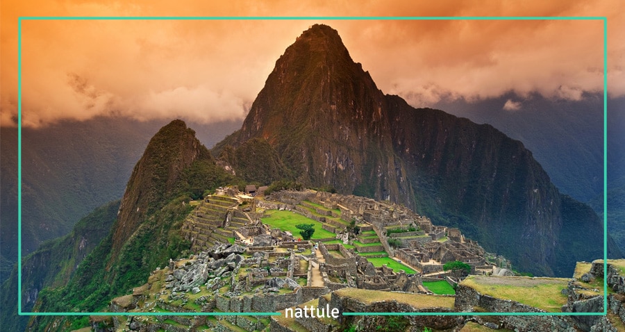
The 5 Stages of a Mystical Trek to Machu Picchu: the Inca Trail
Of all the routes that link to Machu Picchu, the best is the one that Nattule suggests: the Inca Trail.
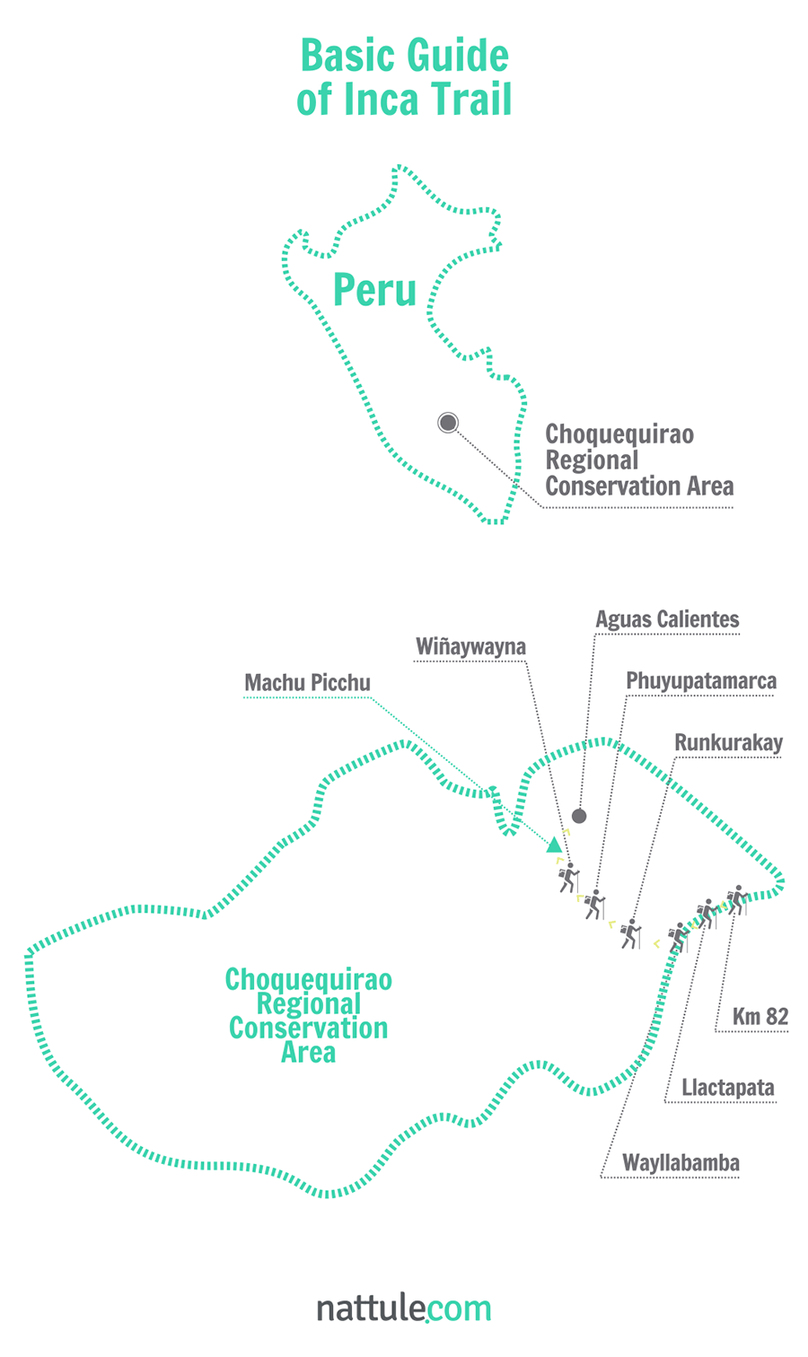
The route connecting the city of Cusco to Machu Picchu is the best known among the ones marked by the Incas, in order to connect the Andes with other areas. In its 43 kilometers, There is an amazing mix of paved roads, stone steps, tunnels and ruins flanked by incredible subtropical forests and mountains surrounded by beauty.
Nattule offers you 5 stages to go through the most famous pedestrian street of America to arrive at this dream destination:
1. Llactapata, Between Two Rivers
Hiking the Inca Trail means embarking on an adventure that begins long before reaching the starting point.
The first thing to decide is the ideal time to visit Machu Picchu. We recommend that you go between April and October, because it coincides with the dry season. However, these are the months with the most visitors. Since there are only 500 people a day allowed on this path, it is important to book a minimum of a half a year in advance, if you want to hike it during this season.
Once you get to Cusco, you must take a bus or a train that takes you to Ollantaytambo. However, we recommend that you stay in Cusco a couple of days to let your body acclimate to the altitude and to avoid altitude sickness.
Ollantaytambo is perched on the banks of the Urubamba River, between two great Inca ruins, and is a perfect example of the architecture of this ancient civilization. There, you can buy your last minute supplies before starting the journey, which begins in the so called kilometer 82, where you have to go through a checkpoint.
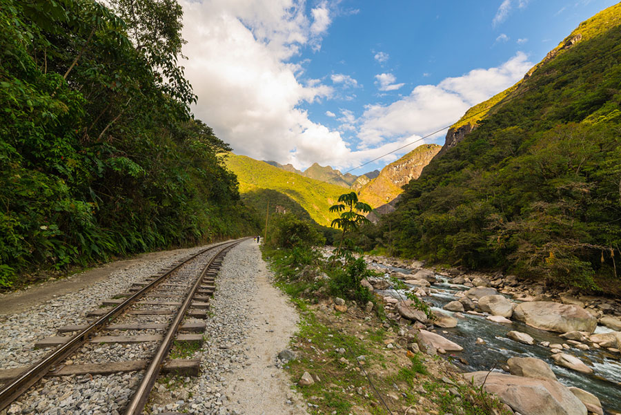 Train tracks along the Urubamba River
After crossing a suspension bridge, you will continue along the river, through forests of giant cactus and endemic shrubs up to Miskay, which is 3 kilometers away. There, the first of many slopes that you will have to overcome will begin. As a reward, the ruins of Llactapata await you, which is the gateway to the Cusichaca River Valley.
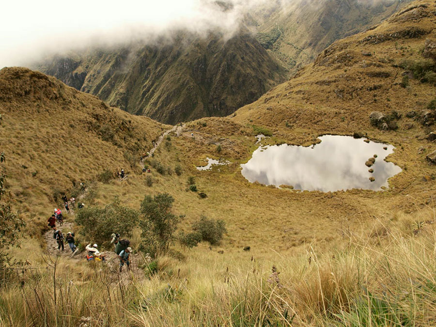
The road along this river is dotted with flashy flowers, such as fuchsias and bromeliads. You'll also enjoy spectacular landscapes of the Vilcanota Mountain Range, with its impressive Veronica Peak, across the river. You will end the day in the farming town of Wayllabamba, a small village that even though it does not have hot water or electricity, will be the perfect place for you to camp.
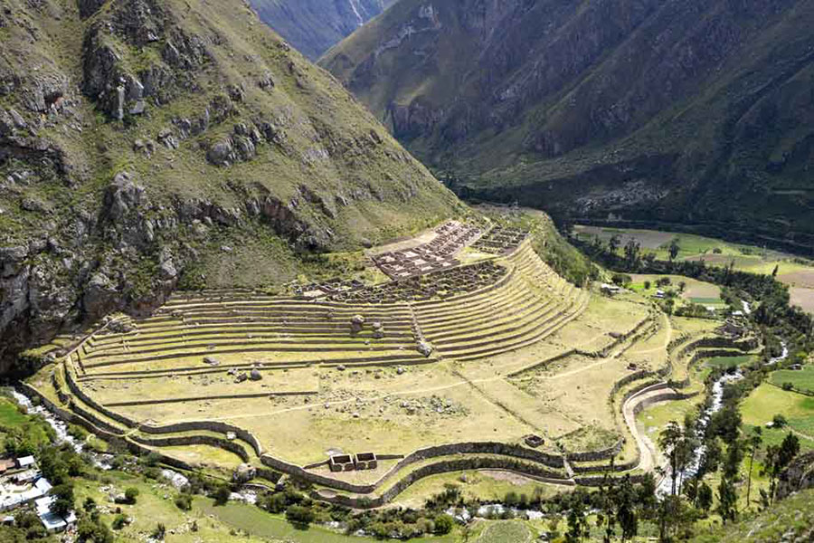 The old city of Llactapata
2. Dead Woman Pass
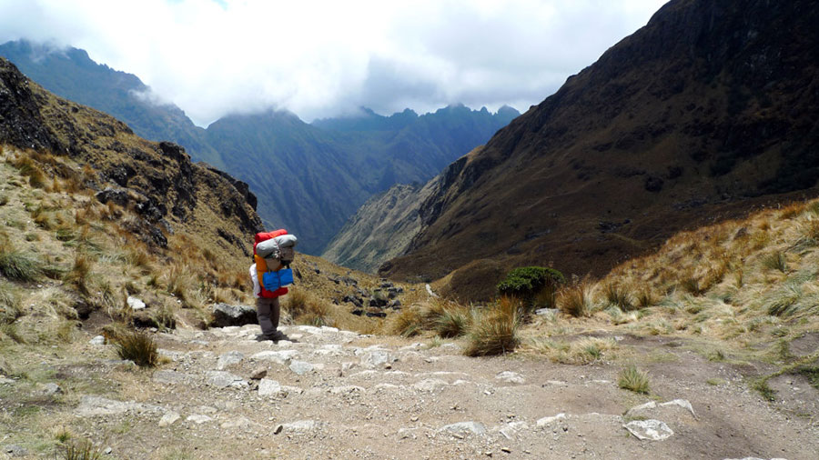
After Wayllabamba, you'll have to face the most difficult part of the route. This is the starting point of a steep climb of 9 kilometers up to the first mountain pass, the Warmiwañusca, also known as the Dead Woman Pass, located at 4,200 meters above sea level. It would be best if you are well acclimated the days beforehand to resist the lack of oxygen.
Your hard work will be compensated by the exceptional nature around you. In the humid forests, abundant vegetation and orchids are distributed everywhere. The sound of hidden waterfalls and birds, such as hummingbirds, will accompany you. In addition, these forests are the habitat of the lonely spectacled bear, also known as the Andean bear, which are very difficult to see.
In the highest areas, the forest becomes puna, a typical high mountain ecosystem characterized by low vegetation. The ichu bushes are the only abundant vegetation, providing food to llamas and vicunas.
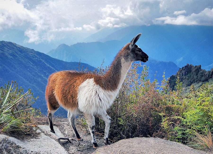 A llama in the high mountain © Jasper Amsing
In about 3 hours you will arrive at Llulluchapampa, a valley with wonderful views all around. A good lunch and a little rest will be needed to face the Warmiwañusca Pass with enough energy, which is located on the top of the mountain. You will reach it in a few hundred meters.
Chewing coca leaves as you go up, as the locals do, will help counteract the effects of the altitude sickness. The journey along this pass will take you another couple of hours climbing up stone steps. With some luck, it is possible that you may see hawks, or even the great Andean condor, in the surrounding peaks.
Once you have crossed the pass, the path leads you to the valley of Pacaymayo. The descent is hard and your knees may suffer after the climb, so do it slowly and at your own pace. The views from this valley, surrounded by snow-capped mountains, are spectacular. Pacaymayo is a frequented camping spot, so you'll have more amenities there than in Wayllabamba.
 Descending the Warmiwañusca Pass
3. The Secrets of the Inca Empire
Just after Pacaymayo, the ascent to Runkurakay Pass begins. An hour later and halfway through, we find the ruins that once served as a temple and a watching point. The journey continues between two small lakes, where Andean gulls sometimes gather. From the top of the pass, the view of the valley, the temple and the forest make for an unforgettable scenery.
 Views from the path on the third day © Richard and Tracy | @travelgasms
Now, it's time to go down. On the descent, you will cross a deep rainforest full of colorful orchids, birds and butterflies that flutter around you. After passing the Chaquacha Lake, you will head to the ruins of Sayacmarca. This circular fortress was divided into two areas: a residential area and a temple. A clever piping construction carried water from the nearby river to homes and ceremonial baths.
 The Inca Trail by the Chaquacha Lake
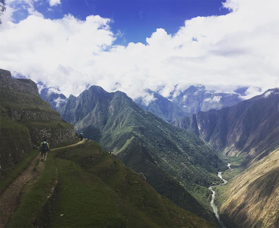
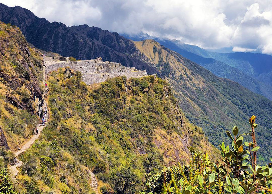
The road remains attached to the mountain. The Incas built their road filling in the gaps that were left in the rock, fixing the slopes of the Andean orography. Even the tunnels are an example of perfectly integrated architecture into the environment. After crossing one of them, you will get the first glimpse of the ruins of the city of Phuyupatamarca, one of the best preserved Inca cities.
You will descend by stone steps to Wiñaywayna, which is the largest archaeological site so far, including the ruins of temples, houses and ceremonial baths.
 Arriving at the Sayacmarca fortress © Jasper Amsing
4. Intipunku: The Gateway to Machu Picchu
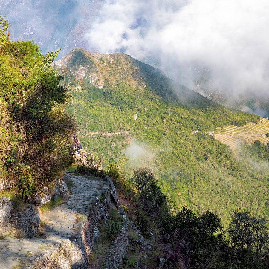
Just like dessert after dinner is the best, the greatest part of camping is the sunrise. The sunrise over the Andes is spectacular. You can enjoy it while embarking on the road to Intipunku, which you should try to begin very early.
After passing Wiñaywayna, you have to continue climbing a rocky path for about an hour to reach Intipunku, the sun gate. The name is no match. Each year on the 24th of June, coinciding with the winter solstice, the sunbeams go through the door and strike the right wall of the temple.
 Looking back from Intipunku © Jasper Amsing
Your goal is very close. From Intipunku, you have a magnificent view of the citadel of Machu Picchu, just 1.5 kilometers away. The ruins are set between the peaks of Machu Picchu and Huayna Picchu, at 2,490 meters above sea level.
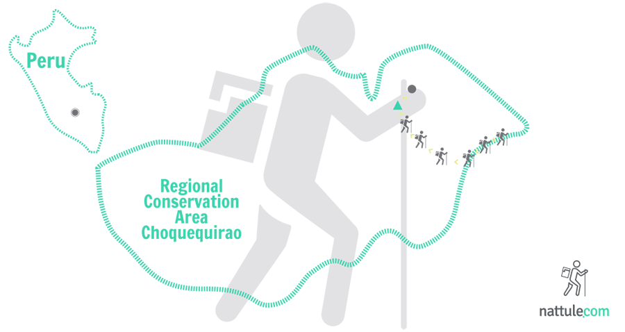
Both the resort and the surrounding territory are part of the Choquequirao Regional Area Conservation, which ensures the protection of several endangered species and several Inca constructions.
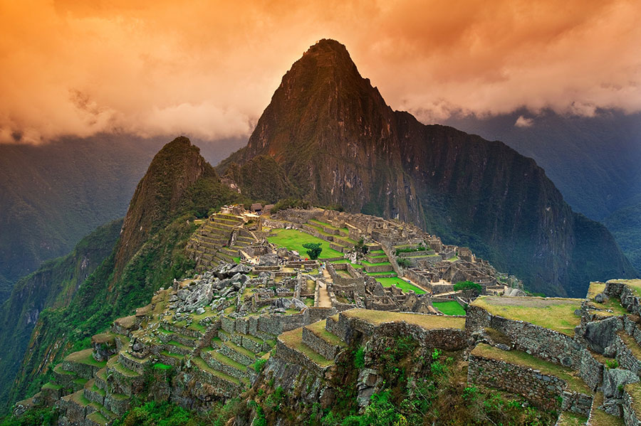 The Inca city of Machu Picchu
5. The Hiram Bingham Path
After visiting Machu Picchu, you have to go to Hot Waters, since it is impossible to stay overnight in the ruins. This village is the only access for tourists who do not dare to hike the Inca Trail. From there, you can head up to the ruins on foot or by bus.
To get to Aguas Calientes, you must go down a road known as the Hiram Bingham Path that runs zig Zag along Mount Machu Picchu. You will cross forests full of orchids. This descent offers incredible views, but be careful because it is the same road for the buses that are going up and down from Aguas Calientes.
 Hot Waters
There are 6 kilometers downhill until you reach Bridge Ruins at the base of the mountain. You must cross the bridge and continue walking along the Urubamba River to Aguas Calientes, about 2 kilometers away.
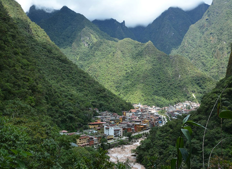
Aguas Calientes is a tourist town, established during the construction of the railway line connecting Cusco to Machu Picchu. This is why it is filled with shops, restaurants and hotels. Inside the Aguas Calientes train station, you can buy your ticket back to Cusco. The fauna is also present in the village. As you walk, you will see hummingbirds or chinchillas.
At 800 meters from the village, there are thermal baths which are said to have medicinal properties. It is the perfect choice to refresh yourself after your adventure.
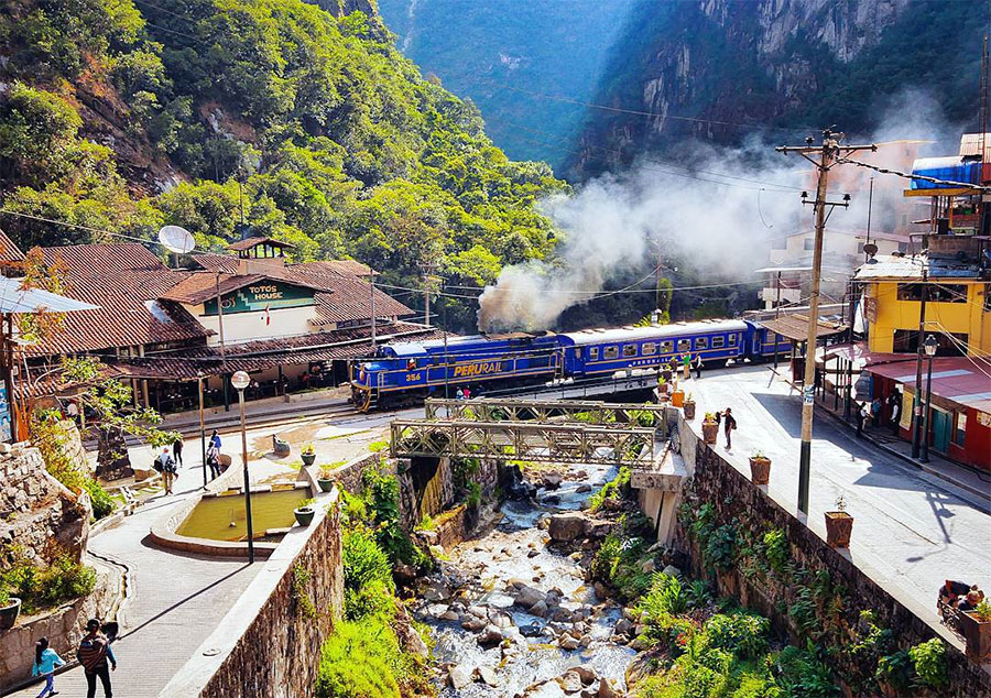 Train Aguas Calientes-Cusco © Jasper Amsing
[hr type=»line»]
The roads leading to Rome are now full of radars. On the road leading to Machu Picchu from Cusco, you must go slowly to enjoy their landscapes which resemble a postcard. Hiking the Inca Trail is almost like stopping time. Time does not run the same during a game of chess as it does during a Cavaliers match. If you want to live fast, do kickboxing, but if you want to live calmly, pay a visit to Peru.
[hr type=»line»]