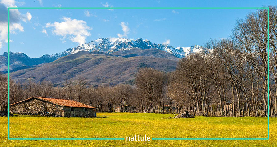
Villuercas Ibores Jara Geopark: a route through the history of Earth.
The Villuercas Ibores Jara Geopark is an ideal place to understand the history of the Earth by observing the landscape or hiking, while practicing bird watching or enjoying the local cuisine.
Villuercas Ibores Jara Geopark
It is part of the European Geoparks Network and the UNESCO Global Geoparks Network.
However, before starting to really know this area of great ecological value, it is convenient to know, for example, some general aspects of what a geopark is or what are the geoparks that we can find in Spain.
Unlike what is usually thought, a geopark is different from what we know as a natural park.
A geopark is a delimited territory characterized by having an outstanding geological heritage in terms of its scientific quality, uniqueness, aesthetic and educational values and that, in addition, has a strategy of sustainable development of the local communities.
The main goal of the geoparks is to conserve and publicize areas of geological importance, where the history of the Earth is explained, in addition to promoting and publicizing the relationship of this geological heritage with aspects of cultural, natural and immaterial values of the area. The geoparks are made up of places of special geological interest, which are known as geosites, but also by localities and customs of the area.
THE GEOPARKS OF SPAIN
The Geopark denomination began to be granted in Europe when the European Network of Geoparks was created in 2000 and, since then, there are several geoparks that we can find in our continent.
Subsequently, UNESCO supported this initiative and extended it to the entire world by creating the Global Geoparks Network.
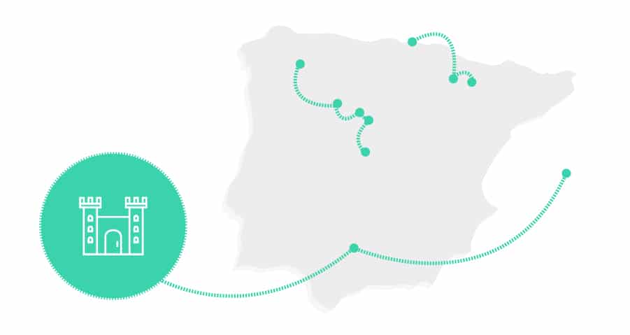
Currently, in Spain there are 11 geoparks:
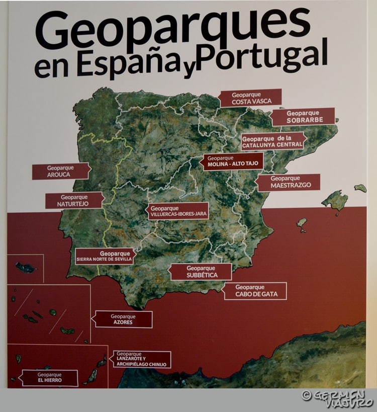
Geoparks of the Iberian Peninsula
- Maestrazgo Geopark
- Cabo de Gata-Níjar
- Sobrarbe
- Subbetic Mountains
- Basque Coast
- Sierra Norte of Seville
- Villuercas Ibores Jara
- Central Catalonia
- Molina Alto-Tajo
- The iron
- Lanzarote and Chinijo Archipelago
Villuercas Ibores Jara Geopark
Now that we know the context, we will focus on the Villuercas Ibores Jara Geopark and everything you need to know to organize a route through this area.
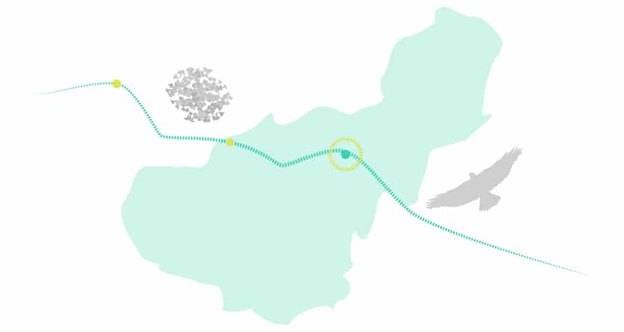
Villuercas Ibores Jara Geopark – Guadarranque Syncline – Gualija
The first thing we are going to do is set this spot on the map, and we will know some interesting things about the area to discover what makes this territory a geopark, or what's the same, what makes this place unique.
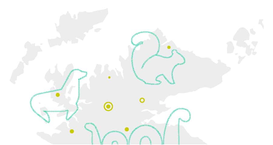
WHERE IS VILLUERCAS IBORES JARA GEOPARK?
The Geopark Villuercas Ibores Jara receives this name due to its location throughout the regions of Villuercas, Ibores and Jara, southeast to the province of Cáceres, in Extremadura.
Villuercas Ibores Jara Geopark – Location map
The mountain ranges and valleys that make up the Villuercas Ibores Jara Geopark are aligned SE-NW and include the land between the Guadiana river basin and the Tagus river basin.
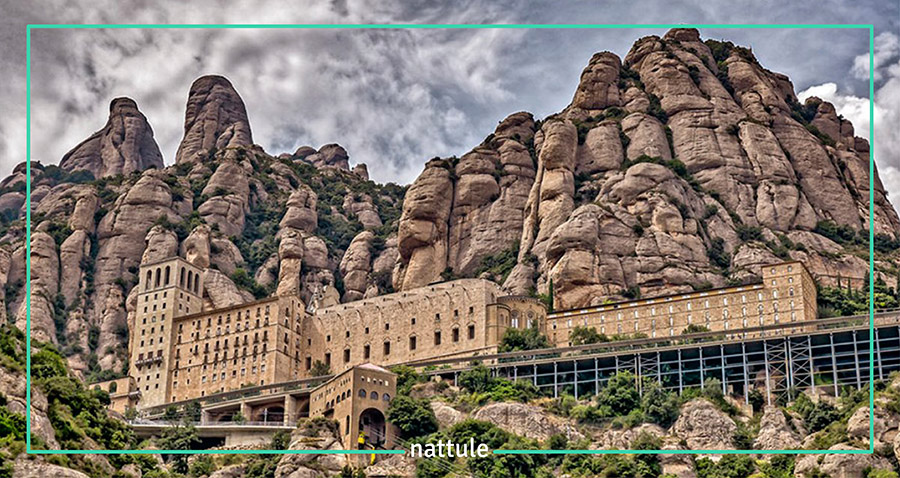
The main population center in Villuercas Ibores Jara Geopark is Guadeloupe (World Heritage Site by UNESCO), where its monastery and its characteristic historical center become a compulsory visit for most travelers passing through the Geopark.
The Geopark Villuercas Ibores Jara in figures
- It was declared as a geopark in September 2011
- It is considered World Geopark by UNESCO since November 2015
- The geopark extends over 2,544 km2
- It has about 45 geosites
- Its highest peak is Risco de la Villuerca, with 1,601 m
- Its origin goes back over 600 million years ago
What makes the Viteruercas Ibores Jara Geopark unique?
As we already know, for a territory to be considered a geopark, it must have a series of geological characteristics that make it unique.
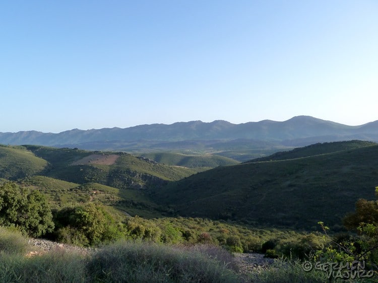
The Geopark Villuercas Ibores Jara has the honor of housing some of the oldest mountains in Europe (more than 600 million years old).
Therefore, it is a perfect place to learn about the history of the Earth through its geological formations and fossils, these last ones being another gem of the Geopark.
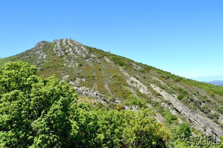
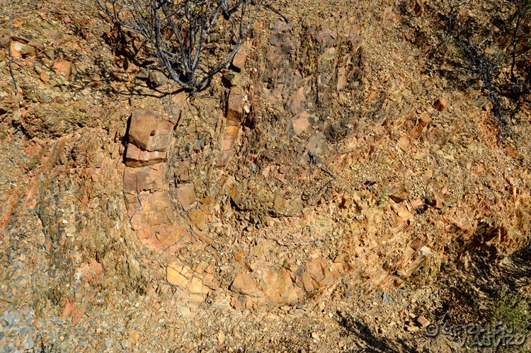
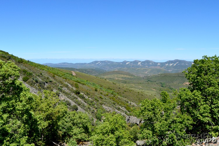
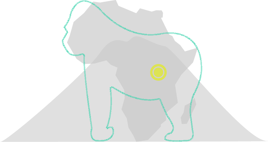
It should be noted the "Appalachian relief" that predominates in this area, was formed at the same time as the one that can be found in USA's Appalachian Mountains.
Villuercas Ibores Jara Geopark – Appalachian relief
It's funny that many nature lovers travel to the American continent to see these mountainous formations, when they are two steps away from their home in Extremadura.
The origin of the Villuercas Ibores Jara Geopark
To better understand what makes this area special, we must go back to its origin.
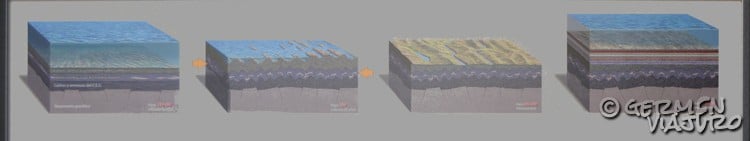
Villuercas Ibores Jara Geopark – Origin
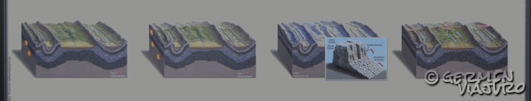
More than 600 million years ago, the Earth had nothing to do with what we know today and, what is currently the Villuercas Ibores Jara Geopark, was occupied by the sea.
In this seabed, different layers of sediments were accumulated and, over the years and due to the forces of the tectonic plates, were folded and transformed into mountains.
In this way a mountainous continent was formed that, with the passage of time, eroded and formed a large peneplain.
Later, about 480 million years ago, this land was flooded again and sediments were deposited on the seabed (covering the previous layers).
The rocks that were formed at this time (the Paleozoic ones) are conglomerates, sandstones, quartzites and slate.
Villuercas Ibores Jara Geopark – Origin
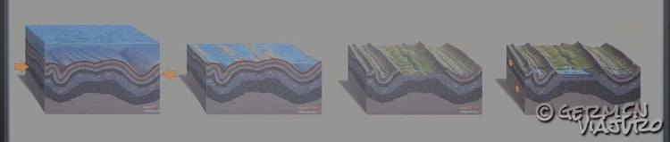
About 300 million years ago, tectonic forces returned to compress the terrain, forming folds and rising anticlines and synclines, so present in the Viteruercas Ibores Jara Geopark. The anticlines are the folds that have the ᴖ shape and the synclines, having the shape ᴗ.
The water came back again and the higher areas of the anticlines were exposed to erosion.
About 280 million years ago and up to 60 million years ago, the new mountain range was eroded, forming a large peneplain in what was originally an anticline.
At the time of the Alpine Orogeny, movements of tectonic plates were created, generating an elevation (which is what we currently know as the Villuercas Peak) and two large depressions (the Guadiana basin to the south and the Tajo basin to the north), as well as great lakes.
Villuercas Ibores Jara Geopark – Origin
In these lakes, sediments were deposited and is what we know today as “Rañas”.
The last tectonic forces, about 3 million years ago, generated fractures and staggered the relief, giving rise to the fluvial network that we can see today in the Viteruercas Ibores Jara Geopark.
Later, during the Preglacial climate at the beginning of the Pleistocene period, the crests of the elevations, which were formed by quartzites, suffered from the effect known as "ice wedge" or "gelivation" creating what we can now call Pedreras.
The stones can be seen on the slopes of the Geopark and, at first glance they look like falling rocks, but in reality they are more than 1 million years old.
Finally, thanks to all these actions of nature on the ground, we finally obtained the Appalachian landscape that we can enjoy today.
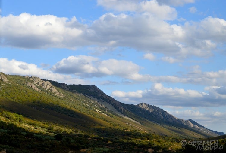
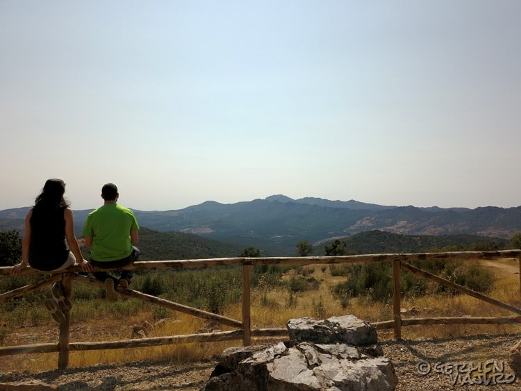
As seen in the last figure, the relief of Villuercas Ibores Jara Geopark is made from mountain chains, mostly oriented with the SE-NW direction.
Villuercas Ibores Jara Geopark – Current view
Once in the Geopark, you can look at the shape of the mountains and see, at first glance, how these folds are distributed reflecting each other as if they were all a mirror.
Knowing the origin of the Viteruercas Ibores Jara Geopark also helps us to know the geosites and know what we are seeing at every moment (rañas, anticlines, synclines, faults, etc.).
The fossils of the Villuercas Ibores Jara Geopark
During the period when the mountains were formed, there was a large number of animals that were trapped between layers of sediment.
Thanks to this, today we can find, in perfect condition, fossils of those animals that inhabited the sea of Extremadura more than 600 million years ago.
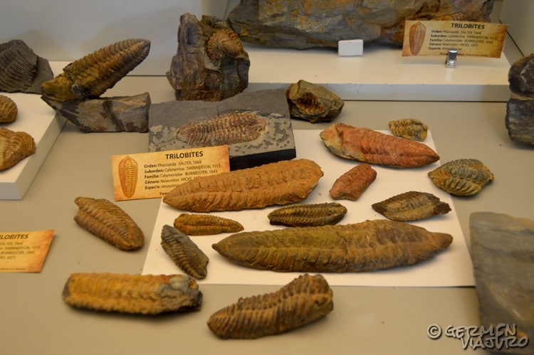
Villuercas Ibores Jara Geopark – Trilobites (Navatrasierra Fossil Interpretation Center)
In the Villuercas Ibores Jara Geopark, numerous examples of Trilobites or Bivalves have been found, for example.
Although, undoubtedly, the queen of fossils is Cloudina Carinata, considered the first animal with the skeleton outside its body (exoskeleton) that preceded many of the animals we know today.
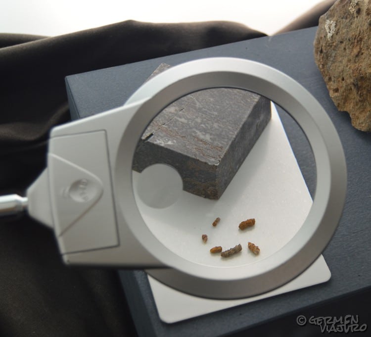
Villuercas Ibores Jara Geopark – Cloudina Carinata (Cañamero's Visitors Reception Center)
This is a fossil difficult to find in the world, since it's one of the oldest, and we are lucky to find it in the Geopark Villuercas Ibores Jara.
The best point to watch and learn about these fossils is undoubtedly the Navatrasierra Fossil Interpretation Center (Calle de las Escuelas, 6).
The visit to the center is free and has the following schedules:
Friday, Saturday and bank holidays:
In Autumn / Winter: from 10 am to 2 pm and from 3 pm to 5 pm
In Spring / Summer: from 10 am to 2 pm and from 4 pm to 6 pm
Sundays and holidays: from 10 am to 2 pm
We want to remind you that it's strictly prohibited to collect fossils from the Geopark.
How to organize a route through the Viteruercas Ibores Jara Geopark by car?
Now that we know in depth the Viteruercas Ibores Jara Geopark, it's time to organize the route.
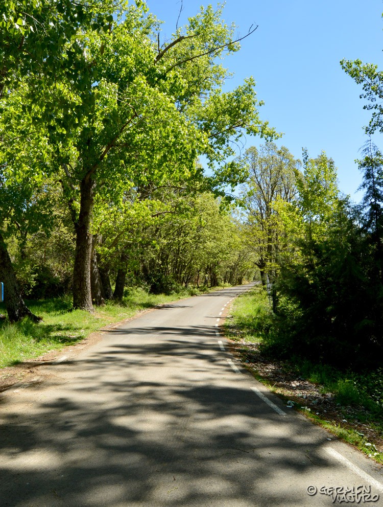
Villuercas Ibores Jara Geopark – Car Route
The best way to make the most of this time is to organize our trip in advance, since there are many geosites you can find in the Geopark, and a previous organization will let you know which ones are most interesting to you and where they are.
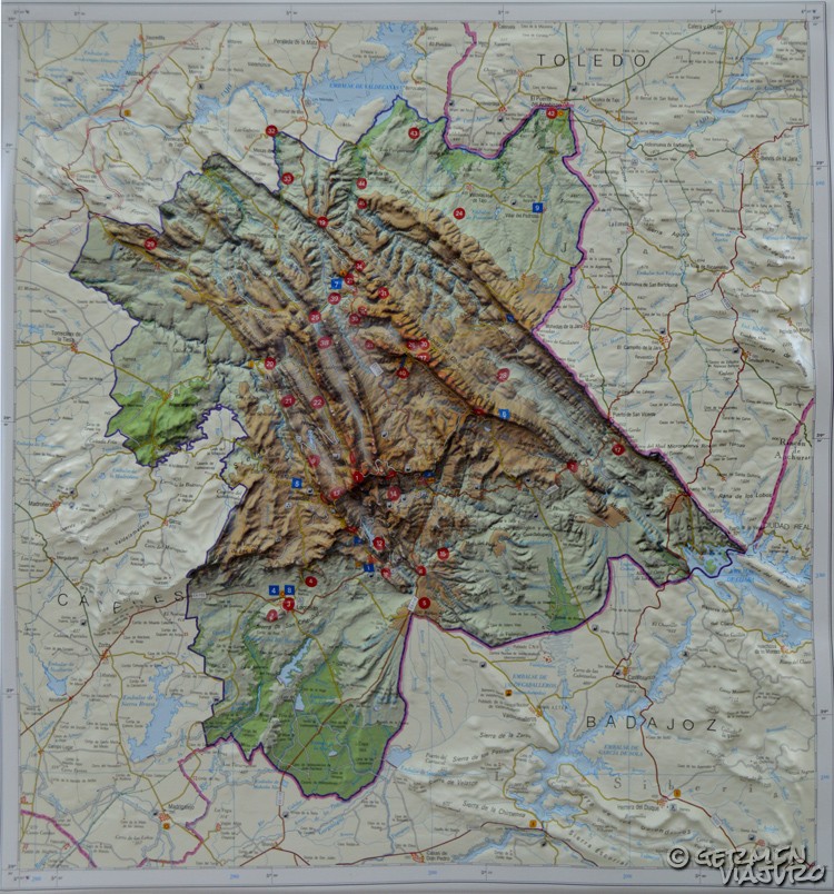
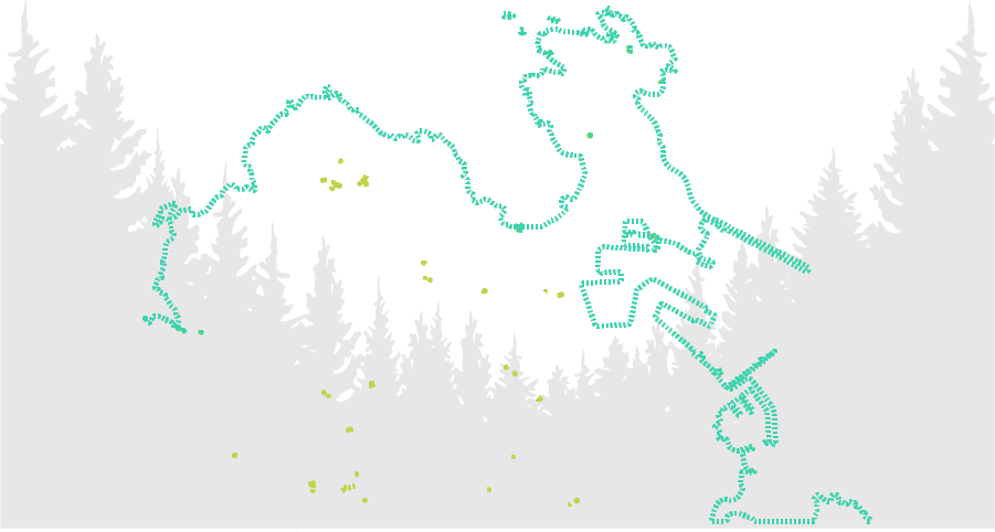
The geosites of Villuercas Ibores Jara Geopark
The Geopark Villuercas Ibores Jara has a total of 45 places of special geological interest (geosites).
These geosites are classified into groups, depending on their morphology. Therefore, we can find:
- Cliffs, hills and mountains
- Frogs
- Failures
- river valleys
- Mining activity
- Canchos and Berrocales
- Pedreras
- Synclines and anticlines
- Other geosites of interest
- Caves
Villuercas Ibores Jara Geopark – Fold
How does it sound that you will get to know every geosite? It's impressive to know that you are seeing or stepping on mountains which origins go back to about 600 million years ago.
And, what could be even more incredible, is that everything we see today as mountains at some point there was just a seabed.
When organizing the visit, keep in mind that some of the geosites are not spotted on the map, and others are not accessible at all, but by watching the geographical features (for example, anticlines or synclines), we can really observe and understand what millions of years did to this land.
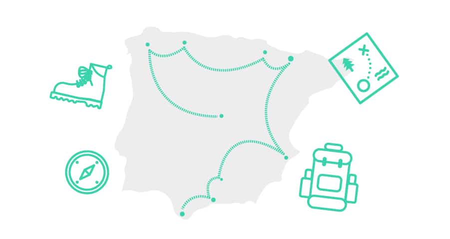
In this map you can see all the geosites of Villuercas Ibores Jara Geopark and its location.
This geosite map is interactive and you can download it to use it on your device. At the end of the article, we'll tell you how you can create your own map.
INTERPRETIVE Centers in Villuercas Ibores Jara Geopark
Another element to take into account when planning a route through Viteruercas Ibores Jara Geopark, is to know where the interpretive centers or visitor centers are, and what can be found in them.
The interpretive centers are focused on the closest geosites of the corresponding areas of each one of them, while, at the Visitor's Center in Viteruercas Ibores Jara Geopark, in the town of Cañamero, you can find some information about the entire Geopark.
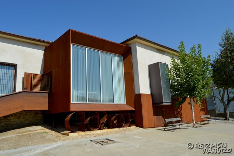
Villuercas Ibores Jara Geopark- Cañamero's Visitors' Center
This Visitors' Center could be said to be the main one. You will find some general explanation of the origins of the Geopark to samples of some of the most visited geosites.
Undoubtedly, we recommend visiting it, before visiting any geosite or starting your visit to the Geopark of Villuercas Ibores Jara. It's best to go through this Visitors' Center because that way you will understand much better what you are seeing and «stepping on».
Therefore, it will be the best starting point to our route through the Villuercas Ibores Jara Geopark.
The address of the Visitors' Center of Cañamero is Paseo de Extremadura, 6 (Cañamero), the entrance is free and the schedule is:
From Monday to Friday from 10 am to 1 pm
Friday from 4 to 6 pm
Saturdays from 9 am to 2 pm and from 4 to 7 pm
Sundays from 9 am to 2 pm
Accommodations and restaurants at the Villuercas Ibores JarA GEOPARK
To organize the route, we will also have to choose where to sleep and where to eat in the Villuercas Ibores Jara Geopark.
When looking for accommodations in the Geopark , you'll find our they are rural accommodations.
As always, the choice will depend on the type of accommodation where you'd like to stay (rural hotel, rural house, etc.), the budget and, above all, the route you are planning to do, since it will depend on choosing a strategic point to enjoy the visit to the max.
Restaurants wise, in the Villuercas Ibores Jara Geopark, at any of the centers, you can find restaurants where you can taste the typical cuisine of the area.
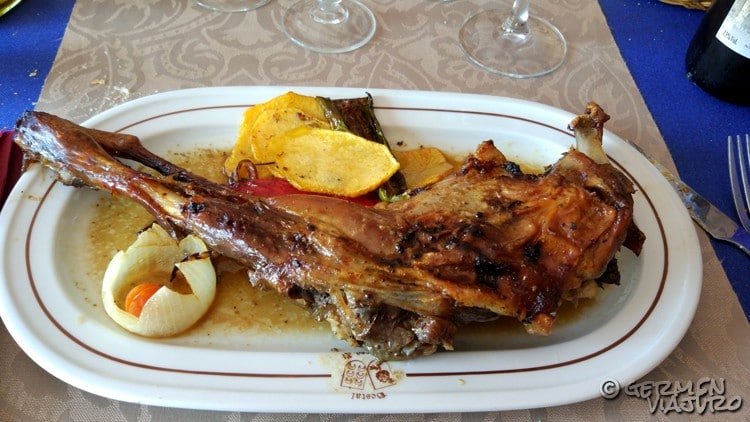
Villuercas Ibores Jara Geopark- Typical dish
If we have to highlight some of the typical products of the Viteruercas Ibores Jara Geopark, they will undoubtedly be the cheese (especially goat's and sheep's cheese), game meat, kid, lamb, honey and, if we eat during the right season, chestnuts.
Of course, we can't forget about the products of the garden of this area, which have an authentic flavor.
Route through the Villuercas Ibores Jara Geopark
Having already all the information about the Villuercas Ibores Jara Geopark, you can keep organizing your own personalized route, choosing to visit certain spots depending on your preferences.
If you need any previous ideas, we have made a map with a route through the Geopark, so you can use it as a guideline.
In this map we have joined the ones that, in our opinion, are the main geosites of the Villuercas Ibores Jara Geopark, as well as points of interest in the area:
Cañamero VisitoRS' Center
As we have said, this should be the starting point for any route through the Viteruercas Ibores Jara Geopark, since you will find all the necessary information to visit this Geopark.
Guadeloupe
Guadalupe has a monastery and a basilica declared as World Heritage Site by UNESCO, and both of them can be visited.
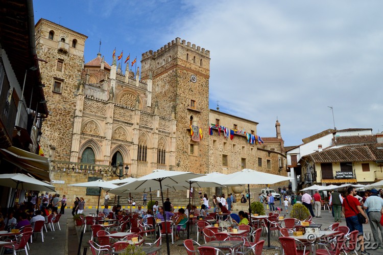
Villuercas Ibores Jara Geopark – Guadalupe
In addition, the center of the town is very well preserved and has a wide range of restaurants and bars, as well as shops where you can buy typical products from the area.
Villuerca cliff
It's the highest peak of the entire Geopark (1601 m) and, from here, there are incredible views of the entire landscape.
It is possible to go up by car or on foot, and there are two alternatives:
For the hermitage of Humilladero (kilometer 4 of the EX-118) or, from Navazuelas, in kilometer 3.6 of the CC-121 road.
Carbonero Cliff
Another peak of the Geopark, where you can also enjoy an incredible view of the whole area, perfect for lovers of photography.
It can be accessed on foot, or driving a section by car and another one on foot, from the forest track that leaves at the height of km 34.5 of the CC-20 road (between Guadalupe and Navatrasierra).
Navatrasierra Fossil Interpretation Center
This is undoubtedly the center that hosts more fossils of all the Villuercas Ibores Jara Geopark, most of them donated by the residents of Navatrasierra, who have been living with these gems of history for decades.
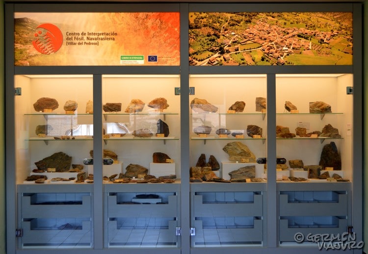
Villuercas Ibores Jara Geopark – Navatrasierra Fossils Interpretation Center
To visit the Navatrasierra Fossils Interpretive Center, we must take into account the opening hours that we have previously mentioned.
Cave of Castañar de Ibor
Due to the conservation of the high value of the cave, your visit is restricted to a number of people per year, who must have a previous appointment requested online.
What you can usually visit is the Interpretive Center of Castañar de Ibor, where you can admire a virtual tour of the cave in 3D, and you will receive all the information about it.
Clock Field
It can be accessed from a forest track that goes to the Garganta de Santa Lucía, on the road between Berzocana and Solana.
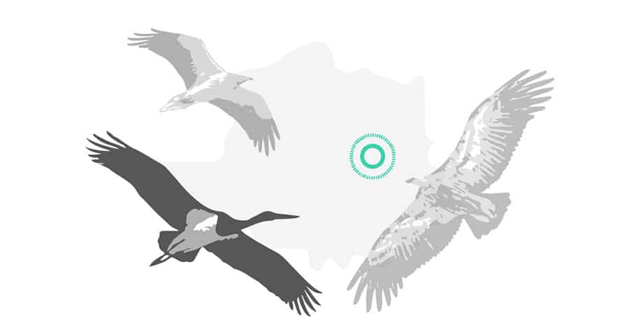
On the way to the top, you can see some archaeological remains and cave paintings and, once on the highest peak, it is possible to see the Santa Lucía syncline, faults and penisplains, as well as raptors (griffon vultures, golden eagles, kestrels or Egyptian vultures, among others).
Arm Hill
This is another point where you can enjoy the scenery, and we have included this spot in this list because it is very accessible with the car and, if you are one of those who don't feel like walking or don't have much time to enjoy a hiking route, this one is a more affordable option.
San Cristobal Hill
The hill of San Cristóbal is an isolated mountain of 680 m of altitude and about 2500 meters of length facing the southwest of Logrosán.
The curious thing about this mountain is that it was originated by cooled magmatic rocks, this means, underneath, there was a time when there was a volcano (in a certain way, it still lingers) and the lava that came to the surface was petrified , creating the hill of San Cristóbal (or batholito of Logrosán, as it's also known).
This is one of the reasons for the mineral wealth of this area.
Costanaza Mine
This phosphorite mine, which was active until 1944, was one of the main extraction points for this material, which was used to manufacture fertilizers that were then exported throughout Europe.
The Costanaza Mine is located at kilometer 45.5 of the EX-102 road, in the vicinity of Logrosán.
Today it is possible to visit the Costanaza Mine, which route includes the galleries where the phosphorite was extracted and, in addition, you can see the museum, the workshops and the laboratory.
The Gorges River Gorge
The Ruecas river is located northwest to Cañamero and runs for about two kilometers parallel to the road (it's the road that goes from Cañamero to Guadalupe).
The route goes along the riverbank, sheltered by rocks, and you will find, among many other caves, the cave of Álvarez or the cave of Chiquita, occupied about 3,500 million years ago, and where you can see cave paintings.
Villuercas Ibores Jara Geopark
Now you have all the information to design your route through the Villuercas Ibores Jara Geopark and, also, if you want to create and customize the map of your route, we leave you a tutorial that we have created for creating personalized road maps, so now you can take your route with you on any mobile device.
This blog is so interesting for me, because I have never seen this type of blog in my life. Thanks for sharing this type of blog, please make more blogs like this.
Mini Tractor
從雋永的CELINE Triomphe凱旋門經典馬鞍包到率性的celine 肩背包。celine 包
thanks Geometry Dash
Nice! Geometry Dash